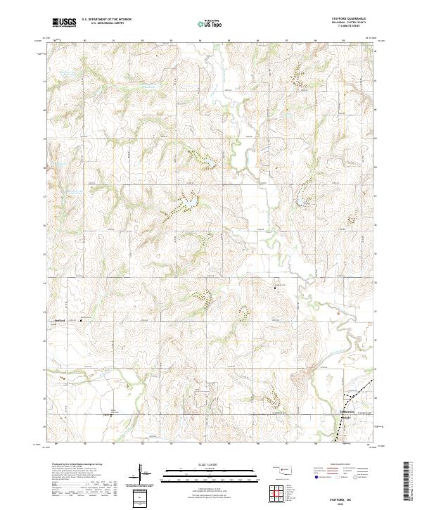
2022 Map of Stafford
USGS Topo · Published 2022About this map
The Washita River and Barnitz Cr drainage basins define this portion of western Oklahoma, where a systematic grid of section roads like e1000 RD and n2190 RD organizes the agricultural landscape. The small community of Stafford serves as a local anchor, centered near the Stafford Cem and the surrounding farmsteads. This 2022 survey illustrates a landscape heavily managed for water conservation, featuring numerous named impoundments such as the Roy Sheppard Reservoir, Hadley Reservoir, and several specific Barnitz Creek flood control sites. To the southeast, the terrain shifts toward the outskirts of Clinton, where the settlement of Ralph and the Valley View Cem sit near the river. The presence of Cabaniss Cem and other family or community burial grounds provides valuable points of reference for genealogists tracing long-established local lineages.
Find a feature on this map
43 named features on this map. Tap any name to fly to it.
Don’t see what you’re looking for? This feature index may not catch every label — zoom into the map to look around manually.
Map Details
Editions of this 2022 Stafford Map
This is the sole edition of this map. No revisions or reprints were ever made.
Other maps of this area

1955 · Clinton
USGS Topo · 1:250,000

1956 · Cordell
USGS Topo · 1:62,500

1957 · Clinton
USGS Topo · 1:250,000

1957 · Butler
USGS Topo · 1:62,500

1957 · Clinton
USGS Topo · 1:62,500

1957 · Dill City
USGS Topo · 1:62,500

1976 · Butler NW
USGS Topo · 1:24,000

1976 · Butler NE
USGS Topo · 1:24,000

1976 · Butler SW
USGS Topo · 1:24,000

1976 · Dill City NE
USGS Topo · 1:24,000