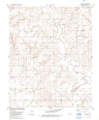
1983 Map of Stafford
USGS Topo · Published 1984About this map
Stafford sits at the heart of this Custer County landscape during the early 1980s, where the rural character is defined by a dense network of energy infrastructure and agricultural field boundaries. The topography is marked by the winding course of the Washita River and the tributaries of Barnitz Creek, which carve through the plains. Local social and family history is preserved at landmarks like the Sunnyside Community Hall and two burial grounds, Valley View Cem and Cabaniss Cem.
Find a feature on this map
17 named features on this map. Tap any name to fly to it.
Don’t see what you’re looking for? This feature index may not catch every label — zoom into the map to look around manually.
Map Details
Editions of this 1983 Stafford Map
This is the sole edition of this map. No revisions or reprints were ever made.
Other maps of this area

1955 · Clinton
USGS Topo · 1:250,000

1956 · Cordell
USGS Topo · 1:62,500

1957 · Clinton
USGS Topo · 1:250,000

1957 · Butler
USGS Topo · 1:62,500

1957 · Clinton
USGS Topo · 1:62,500

1957 · Dill City
USGS Topo · 1:62,500

1976 · Butler NW
USGS Topo · 1:24,000

1976 · Butler NE
USGS Topo · 1:24,000

1976 · Butler SW
USGS Topo · 1:24,000

1976 · Dill City NE
USGS Topo · 1:24,000