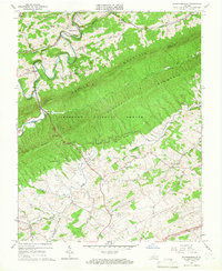
1965 Map of Staffordsville
USGS Topo · Published 1966About this map
Walker Mountain and Coyds Mountain dominate this mid-1960s landscape, their forested ridges separated by the winding course of Walker Creek. This survey captures the rural character of the Giles and Pulaski county border, where small settlements like Staffordsville and Poplar Hill are linked by valley roads and the N. & W. Ry. line. The map highlights a community-focused geography, documenting local landmarks such as the Shannon-King Sch and several country churches, including Wesley Chapel and French Chapel.
Find a feature on this map
36 named features on this map. Tap any name to fly to it.
Don’t see what you’re looking for? This feature index may not catch every label — zoom into the map to look around manually.
Map Details
Editions of this 1965 Staffordsville Map
Other maps of this area

1890 · Dublin
USGS Topo · 1:125,000

1891 · Dublin
USGS Topo · 1:125,000

1913 · Peterstown
USGS Topo · 1:48,000

1916 · Peterstown
USGS Topo · 1:62,500

1923 · Pearisburg
USGS Topo · 1:62,500

1925 · Peterstown
USGS Topo · 1:62,500

1932 · Peterstown
USGS Topo · 1:48,000

1932 · Pearisburg
USGS Topo · 1:48,000

1934 · Pulaski
USGS Topo · 1:48,000

1937 · Pearisburg
USGS Topo · 1:62,500