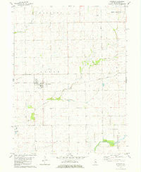
1981 Map of Stanford
USGS Topo · Published 1981About this map
The village of Stanford sits as the central hub of this agricultural landscape in the early 1980s, intersected by the Illinois Central Gulf railroad. This map delineates the boundary of the Third Principal Meridian, a critical surveying line that dictates the property layouts across central Illinois. Rural life is anchored by local landmarks such as Mt Pleasant Ch and the Olympia High Sch located on the southern edge of the township. The terrain is defined by the branching waterways of the Sugar Creek system, including the West Fork Sugar Creek and Middle Fork Sugar Creek, which drain the surrounding prairie. Genealogists will find interest in the well-marked Brooks Grove Cem, while the township boundaries of Allin, Danvers, and Mount Hope provide a clear spatial framework for historical land research.
Find a feature on this map
17 named features on this map. Tap any name to fly to it.
Don’t see what you’re looking for? This feature index may not catch every label — zoom into the map to look around manually.
Map Details
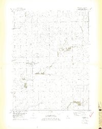
Editions of this 1981 Stanford Map
2 editions found
Other maps of this area

1927 · Danvers
USGS Topo · 1:62,500

1928 · Mackinaw
USGS Topo · 1:62,500

1930 · Danvers
USGS Topo · 1:62,500

1932 · Mackinaw
USGS Topo · 1:62,500

1949 · Mc Lean
USGS Topo · 1:62,500

1951 · McLean
USGS Topo · 1:62,500

1951 · Minier
USGS Topo · 1:62,500

1958 · Peoria
USGS Topo · 1:250,000

1961 · Peoria
USGS Topo · 1:250,000

1963 · Peoria
USGS Topo · 1:250,000