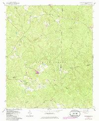
1964 Map of Stanfordville
USGS Topo · Published 1986About this map
The Oconee National Forest covers much of this mid-century landscape at the junction of Jasper, Jones, and Putnam counties. The map documents the mid-century rural character of the region, anchored by the Uncle Remus Dist Headquarters and the Hillsboro Lake Recreation Area. Small communities and agricultural centers like Stanfordville and Goolsby are visible, alongside a network of country churches including Mt Carmel Ch, Wesley Chapel, and Griggs Chapel.
Find a feature on this map
29 named features on this map. Tap any name to fly to it.
Don’t see what you’re looking for? This feature index may not catch every label — zoom into the map to look around manually.
Map Details
Editions of this 1964 Stanfordville Map
3 editions found
Other maps of this area

1953 · Athens
USGS Topo · 1:250,000

1958 · Athens
USGS Topo · 1:250,000

1959 · Athens
USGS Topo · 1:250,000

1963 · Athens
USGS Topo · 1:250,000

1964 · Gray
USGS Topo · 1:24,000
1964 · Dames Ferry
USGS Topo · 1:24,000

1964 · Stanfordville
USGS Topo · 1:24,000

1964 · Hillsboro
USGS Topo · 1:24,000

1972 · Monticello
USGS Topo · 1:24,000

1972 · Eatonton
USGS Topo · 1:24,000