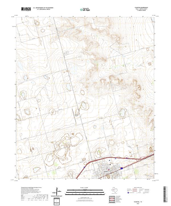
2022 Map of Stanton
USGS Topo · Published 2022About this map
The West Texas town of Stanton serves as the focal point of this survey, anchored by the Martin County Courthouse and the surrounding street grid. The local landscape is defined by the subtle drainage of Calf Cr to the north and Hamilton Draw to the south, showcasing the characteristic topography of the Llano Estacado. The settlement patterns here reflect the importance of regional connectivity, with numerous county roads such as Co RD 2900 and Co RD 2400 branching out into the surrounding ranching and agricultural lands. On the edge of town, the Saint Joseph Cem and Stanton Municipal Airport provide specific points of interest for genealogists and local historians tracing the development of this Martin County seat. The presence of irrigation and water management is evident in the scattered tanks and drainage patterns that crisscross the dry plains.
Find a feature on this map
53 named features on this map. Tap any name to fly to it.
Don’t see what you’re looking for? This feature index may not catch every label — zoom into the map to look around manually.
Map Details
Editions of this 2022 Stanton Map
This is the sole edition of this map. No revisions or reprints were ever made.
Other maps of this area

1941 · Morita
USGS Topo · 1:62,500

1949 · Morita
USGS Topo · 1:62,500

1954 · Big Spring
USGS Topo · 1:250,000

1958 · Big Spring
USGS Topo · 1:250,000

1966 · Lenorah West
USGS Topo · 1:24,000

1966 · Natural Dam Lake
USGS Topo · 1:24,000
1966 · Germania
USGS Topo · 1:24,000
1966 · Houston Ranch
USGS Topo · 1:24,000

1966 · Stanton
USGS Topo · 1:24,000

1966 · Knott SW
USGS Topo · 1:24,000