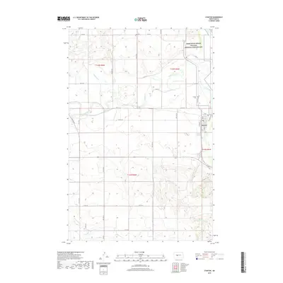
2018 Map of Stanton
USGS Topo · Published 2018About this map
The Knife River meanders across this northern Great Plains landscape, anchoring the historical and geographical identity of the region near the city of Stanton. To the north, the Knife River Indian Villages National Historic Site preserves a critical archaeological landscape where multiple tribal communities lived and traded for centuries. The settlement pattern of the early 21st century follows a rigid section-line grid of rural roads, including Co Rd 37 and Co Rd 18, which cross the drainage basins of Raymond Cr and Elm Cr. Genealogy researchers can identify local burial sites at Zion Cem in the north and Stanton Cem just west of the town center. The confluence of these prairie waterways with the larger river system shaped the placement of local streets like Main St and Harmon Ave, reflecting the enduring relationship between the community and the water.
Find a feature on this map
36 named features on this map. Tap any name to fly to it.
Don’t see what you’re looking for? This feature index may not catch every label — zoom into the map to look around manually.
Map Details
Editions of this 2018 Stanton Map
This is the sole edition of this map. No revisions or reprints were ever made.
Other maps of this area

1948 · Stanton
USGS Topo · 1:62,500

1949 · Stanton
USGS Topo · 1:62,500

1954 · McClusky
USGS Topo · 1:250,000

1958 · McClusky
USGS Topo · 1:250,000

1967 · Stanton SE
USGS Topo · 1:24,000

1968 · Hannover NE
USGS Topo · 1:24,000

1968 · Red Butte
USGS Topo · 1:24,000

1968 · Stanton
USGS Topo · 1:24,000

1968 · Hannover NW
USGS Topo · 1:24,000

1968 · Hazen East
USGS Topo · 1:24,000