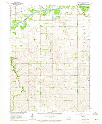
1966 Map of Stanton SW
USGS Topo · Published 1986About this map
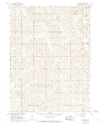
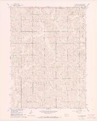
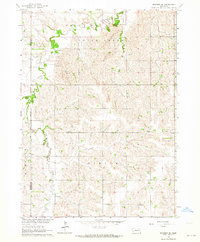
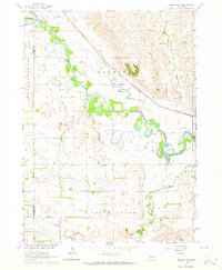
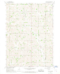
Rural life in the mid-1960s across Stanton County is defined by a dense network of country schoolhouses and small family landmarks. This portion of the Missouri River Basin development area highlights a landscape of rolling drainages including Butterfly Creek and Wells Creek, where the land is partitioned into distinct local districts like Butterfly, Haymow, and Ramshorn. These names reflect the agricultural character of the era, where local education was still decentralized at sites such as Pleasant Hill Sch and Butterfly Sch. Genealogy researchers will find significant value in the location of the Erychleb Cem and the various sand and gravel operations, such as the Sandpit near Wells Creek, which point to the local resource extraction supporting the county's road network during this period.
Find a feature on this map
13 named features on this map. Tap any name to fly to it.
Don’t see what you’re looking for? This feature index may not catch every label — zoom into the map to look around manually.
Map Details
Editions of this 1966 Stanton SW Map
2 editions found
Other maps of this area

1955 · Fremont
USGS Topo · 1:250,000

1957 · Fremont
USGS Topo · 1:250,000

1958 · Fremont
USGS Topo · 1:250,000
1963 · Madison SE
USGS Topo · 1:24,000
1963 · Madison NE
USGS Topo · 1:24,000
1963 · Stanton NE
USGS Topo · 1:24,000
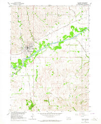
1963 · Stanton
USGS Topo · 1:24,000
1966 · Clarkson
USGS Topo · 1:24,000
1966 · Creston
USGS Topo · 1:24,000
1966 · Stanton SE
USGS Topo · 1:24,000