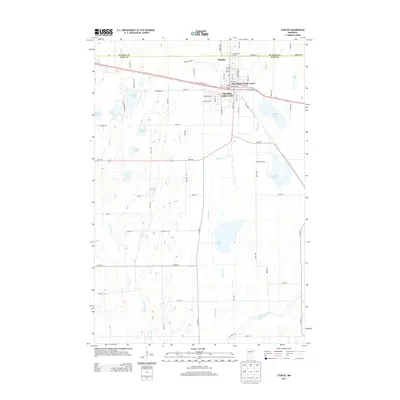
2013 Map of Staples
USGS Topo · Published 2013About this map
Staples sits at the northern edge of this 2013 survey, straddling the boundary between Wadena Co and Todd Co. The settlement pattern here is defined by its position at the junction of Us-10 and MN-210, with local neighborhoods including the Pine Ridge Trailer Court and Oak Ridge Trailer Court. A post office (Po) and Evergreen Cem serve the town, while Spectrum Park offers a dedicated green space near the center of the community.
Find a feature on this map
69 named features on this map. Tap any name to fly to it.
Don’t see what you’re looking for? This feature index may not catch every label — zoom into the map to look around manually.
Map Details
Editions of this 2013 Staples Map
This is the sole edition of this map. No revisions or reprints were ever made.
Other maps of this area

1948 · Cushing
USGS Topo · 1:62,500

1950 · Cushing
USGS Topo · 1:62,500

1953 · Brainerd
USGS Topo · 1:250,000

1957 · Brainerd
USGS Topo · 1:250,000

1958 · Brainerd
USGS Topo · 1:250,000

1963 · Motley
USGS Topo · 1:24,000

1965 · Brainerd
USGS Topo · 1:250,000

1966 · Staples NE
USGS Topo · 1:24,000
1966 · Motley NW
USGS Topo · 1:24,000
1966 · Browerville NE
USGS Topo · 1:24,000