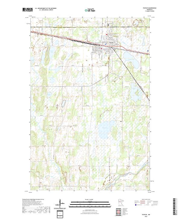
2022 Map of Staples
USGS Topo · Published 2022About this map
Staples serves as the primary hub for this Minnesota landscape, where the boundary between Wadena Co and Todd Co divides the northern and southern halves of the quadrangle. The town's grid is dense with residential streets like Minnesota Ave SW and Michigan Ave NE, while Evergreen Cem sits just to the north. Outside the town center, the terrain is defined by a high concentration of glacial water bodies, from the larger Dower Lake and Hayden Lake to smaller pockets like Jacobson Lake and Mumm Lake. The Long Prairie River and the Long Prairie River Trl cut across the southeastern corner, supported by a network of drainage including Stony Brook and Moran Cr. This topography suggests a moist, low-lying environment where agriculture and rural homesteads must navigate between numerous wetlands and named lakes such as Rice Lake and Jasmer Lake.
Find a feature on this map
54 named features on this map. Tap any name to fly to it.
Don’t see what you’re looking for? This feature index may not catch every label — zoom into the map to look around manually.
Map Details
Editions of this 2022 Staples Map
This is the sole edition of this map. No revisions or reprints were ever made.
Other maps of this area

1948 · Cushing
USGS Topo · 1:62,500

1950 · Cushing
USGS Topo · 1:62,500

1953 · Brainerd
USGS Topo · 1:250,000

1957 · Brainerd
USGS Topo · 1:250,000

1958 · Brainerd
USGS Topo · 1:250,000

1963 · Motley
USGS Topo · 1:24,000

1965 · Brainerd
USGS Topo · 1:250,000

1966 · Staples NE
USGS Topo · 1:24,000
1966 · Motley NW
USGS Topo · 1:24,000
1966 · Browerville NE
USGS Topo · 1:24,000