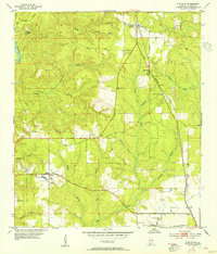
1953 Map of Stapleton
USGS Topo · Published 1955About this map
Stapleton and the surrounding Baldwin County landscape are defined here by a transition from upland pine forests to the intricate creek networks of the Gulf Coast. The Louisville and Nashville railroad serves as the primary spine of the region, running through Steelwood and Stapleton. To the southwest, the settlement of Malbis appears alongside the Old Spanish Trail, reflecting the area's deep-rooted transportation history and agricultural heritage. Numerous family and community landmarks are documented, including Mt Zion Ch, Sibley Cem, and the Durant Cem near Bromley. The terrain is deeply incised by watercourses such as Bay Minette Creek and the Fish River, while industrial and safety infrastructure is marked by several Sand Pits and the Simerly Lookout Tower.
Find a feature on this map
40 named features on this map. Tap any name to fly to it.
Don’t see what you’re looking for? This feature index may not catch every label — zoom into the map to look around manually.
Map Details
Editions of this 1953 Stapleton Map
3 editions found
Other maps of this area

1920 · Robertsdale
USGS Topo · 1:62,500

1921 · Fairhope
USGS Topo · 1:62,500

1939 · Daphne
USGS Topo · 1:31,680

1940 · Silverhill
USGS Topo · 1:31,680

1941 · Daphne
USGS Topo · 1:31,680

1941 · Silverhill
USGS Topo · 1:31,680

1941 · Blakeley
USGS Topo · 1:31,680

1941 · Bay Minette
USGS Topo · 1:62,500

1941 · Robertsdale
USGS Topo · 1:62,500

1941 · Fairhope
USGS Topo · 1:62,500