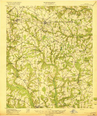
1920 Map of Stapleton
USGS Topo · Published 1920About this map
Stapleton and the surrounding Georgia countryside appear here during a period of steady agricultural and rail-based activity. The Southern railroad serves as a primary transit artery, connecting Wrens and Matthews to the wider region. The landscape is defined by its social infrastructure, with dozens of small institutions like Logyard School and Ebenezer Church distributed across the drainage basins of Brushy Creek and Duhart Creek.
Find a feature on this map
85 named features on this map. Tap any name to fly to it.
Don’t see what you’re looking for? This feature index may not catch every label — zoom into the map to look around manually.
Map Details
Editions of this 1920 Stapleton Map
3 editions found
Other maps of this area

1919 · Gough
USGS Topo · 1:62,500

1920 · Stapleton
USGS Topo · 1:62,500

1922 · Harlem
USGS Topo · 1:62,500

1922 · Hephzibah
USGS Topo · 1:62,500

1948 · Hephzibah
USGS Topo · 1:62,500

1948 · Harlem
USGS Topo · 1:62,500

1948 · Stapleton
USGS Topo · 1:62,500

1948 · Gough
USGS Topo · 1:62,500

1948 · Blythe
USGS Topo · 1:24,000

1948 · Louisville
USGS Topo · 1:24,000