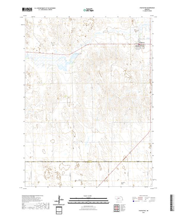
2021 Map of Stapleton
USGS Topo · Published 2021About this map
The village of Stapleton serves as the focal point of this Logan County landscape, situated where the northern plains transition into the elevated Garfield Table. As the county seat, the village is anchored by the Logan County Courthouse, with its street grid defined by Main St and numbered avenues. The winding course of the S Loup River, also labeled as the South Loup River, cuts across the northern territory, creating a distinct riparian corridor through the otherwise undulating terrain.
Find a feature on this map
24 named features on this map. Tap any name to fly to it.
Don’t see what you’re looking for? This feature index may not catch every label — zoom into the map to look around manually.
Map Details
Editions of this 2021 Stapleton Map
This is the sole edition of this map. No revisions or reprints were ever made.
Other maps of this area

1899 · North Platte
USGS Topo · 1:125,000

1902 · North Platte
USGS Topo · 1:125,000

1949 · Cody Lake
USGS Topo · 1:62,500

1951 · Cody Lake
USGS Topo · 1:62,500

1951 · Hoagland
USGS Topo · 1:62,500

1954 · North Platte
USGS Topo · 1:250,000

1956 · North Platte
USGS Topo · 1:250,000

1957 · North Platte
USGS Topo · 1:250,000

1967 · North Platte
USGS Topo · 1:250,000

1972 · Stapleton NW
USGS Topo · 1:24,000