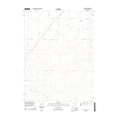
2014 Map of Stapleton SE
USGS Topo · Published 2014About this map
Garfield Table defines the high ground of this Lincoln County landscape, where the plateau surface meets the headwaters of numerous draws. The area is characterized by a sparse, grid-based road network that reflects the expansive agricultural nature of the Nebraska plains in the early 21st century. Us-83 cuts diagonally across the northwestern corner, serving as the primary corridor through this section of the state. Genealogists and local historians will find the Myrtle Cem near E Kilmar Valley Rd, a significant local landmark in an otherwise open terrain. The map records several family-named thoroughfares, such as Lehman Rd, Classen Rd, and N Walz Rd, which outline the boundaries of large land holdings and rural homesteads.
Find a feature on this map
25 named features on this map. Tap any name to fly to it.
Don’t see what you’re looking for? This feature index may not catch every label — zoom into the map to look around manually.
Map Details
Editions of this 2014 Stapleton SE Map
This is the sole edition of this map. No revisions or reprints were ever made.
Other maps of this area

1899 · North Platte
USGS Topo · 1:125,000

1902 · North Platte
USGS Topo · 1:125,000

1954 · North Platte
USGS Topo · 1:250,000

1956 · North Platte
USGS Topo · 1:250,000

1957 · North Platte
USGS Topo · 1:250,000

1967 · North Platte
USGS Topo · 1:250,000

1970 · North Platte East
USGS Topo · 1:24,000
1970 · Maxwell NE
USGS Topo · 1:24,000

1972 · Stapleton NW
USGS Topo · 1:24,000
1972 · Stapleton
USGS Topo · 1:24,000