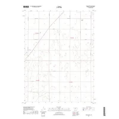
2017 Map of Stapleton SE
USGS Topo · Published 2017About this map
Garfield Table defines the northern reaches of this Lincoln County landscape, where the high plains of Nebraska meet a network of rural section roads. For genealogists and local historians, the Myrtle Cem stands as a focal point for family research in Township 16 North. The map reveals a highly structured agricultural grid, where long thoroughfares such as E Garfield Table Rd and N Cattle Growers Rd facilitate movement across the plateau. The drainage patterns and topographic contours shown here illustrate the transition between the level tableland and the more dissected terrain further south. This 2017 survey reflects the persistent ranching and farming heritage of the region, anchored by established routes like E Niedan Rd and Stewart Rd.
Find a feature on this map
21 named features on this map. Tap any name to fly to it.
Don’t see what you’re looking for? This feature index may not catch every label — zoom into the map to look around manually.
Map Details
Editions of this 2017 Stapleton SE Map
This is the sole edition of this map. No revisions or reprints were ever made.
Other maps of this area

1899 · North Platte
USGS Topo · 1:125,000

1902 · North Platte
USGS Topo · 1:125,000

1954 · North Platte
USGS Topo · 1:250,000

1956 · North Platte
USGS Topo · 1:250,000

1957 · North Platte
USGS Topo · 1:250,000

1967 · North Platte
USGS Topo · 1:250,000

1970 · North Platte East
USGS Topo · 1:24,000
1970 · Maxwell NE
USGS Topo · 1:24,000

1972 · Stapleton NW
USGS Topo · 1:24,000
1972 · Stapleton
USGS Topo · 1:24,000