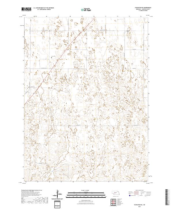
2021 Map of Stapleton SE
USGS Topo · Published 2021About this map
Garfield Table dominates the northern reaches of this Lincoln County landscape, defining the high, flat geography of the Nebraska sandhills region. The map reveals a systematic grid of section lines and rural access roads that serve the sprawling agricultural and ranching operations of the early 21st century. Notable family-named or descriptive routes such as N Cattle Growers Rd, E Garfield Table Rd, and E Niedan Rd provide the primary infrastructure for this sparsely populated area. For genealogists and local historians, the placement of Myrtle Cem near N Hodges Rd provides a specific point of interest, marking a legacy of early settlement amidst the modern landscape of E Auble Rd and Kilmar Rd.
Find a feature on this map
21 named features on this map. Tap any name to fly to it.
Don’t see what you’re looking for? This feature index may not catch every label — zoom into the map to look around manually.
Map Details
Editions of this 2021 Stapleton SE Map
This is the sole edition of this map. No revisions or reprints were ever made.
Other maps of this area

1899 · North Platte
USGS Topo · 1:125,000

1902 · North Platte
USGS Topo · 1:125,000

1954 · North Platte
USGS Topo · 1:250,000

1956 · North Platte
USGS Topo · 1:250,000

1957 · North Platte
USGS Topo · 1:250,000

1967 · North Platte
USGS Topo · 1:250,000

1970 · North Platte East
USGS Topo · 1:24,000
1970 · Maxwell NE
USGS Topo · 1:24,000

1972 · Stapleton NW
USGS Topo · 1:24,000
1972 · Stapleton
USGS Topo · 1:24,000