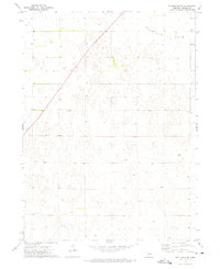
1972 Map of Stapleton SE
USGS Topo · Published 1975About this map
Garfield Table dominates the northern landscape of this Lincoln County quadrangle, showing the distinct upland topography of the Nebraska Sandhills during the early 1970s. The region is sparsely settled, defined by isolated operations such as the Nowak Ranch and Stewart Ranch, reflecting the enduring ranching economy of the plains. A small cluster of human history is preserved at the site of Myrtle, where the Myrtle Cem stands as a primary genealogical landmark for researchers tracing early families in this portion of the state. Numerous well sites are mapped across the terrain, indicating the critical importance of groundwater management for livestock and habitation in this high tableland environment. The map captures the specialized land use patterns required to sustain life in a territory where water sources and family ranch holdings are the primary geographic anchors.
Find a feature on this map
7 named features on this map. Tap any name to fly to it.
Don’t see what you’re looking for? This feature index may not catch every label — zoom into the map to look around manually.
Map Details
Editions of this 1972 Stapleton SE Map
This is the sole edition of this map. No revisions or reprints were ever made.
Other maps of this area

1899 · North Platte
USGS Topo · 1:125,000

1902 · North Platte
USGS Topo · 1:125,000

1954 · North Platte
USGS Topo · 1:250,000

1956 · North Platte
USGS Topo · 1:250,000

1957 · North Platte
USGS Topo · 1:250,000

1967 · North Platte
USGS Topo · 1:250,000

1970 · North Platte East
USGS Topo · 1:24,000
1970 · Maxwell NE
USGS Topo · 1:24,000

1972 · Stapleton NW
USGS Topo · 1:24,000
1972 · Stapleton
USGS Topo · 1:24,000