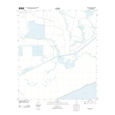
2013 Map of Star Lake
USGS Topo · Published 2013About this map
Star Lake and its surrounding wetlands dominate this coastal Jefferson County landscape, where the land fragmentizes into a complex system of bayous and man-made waterways. The presence of Spindletop-Ditch and Spindletop Gully indicates a long-standing history of water management and drainage across these low-lying marshlands. This 2013 survey illustrates the interface between the interior brackish waters and the open expanse of the Gulf of Mexico along the Texas coast. While primarily an aquatic environment, transit is facilitated by corridors like Clam Lake Rd, which cuts through the marsh toward Salt Bayou and Fivemile Cut. Smaller water bodies such as Little Lake and Willie Slough further define the intricate hydrography of this coastal quadrangle, offering a detailed view of the region's shifting shoreline and hydrological patterns.
Find a feature on this map
10 named features on this map. Tap any name to fly to it.
Don’t see what you’re looking for? This feature index may not catch every label — zoom into the map to look around manually.
Map Details
Editions of this 2013 Star Lake Map
This is the sole edition of this map. No revisions or reprints were ever made.
Other maps of this area

1950 · Houston
USGS Topo · 1:250,000

1956 · Houston
USGS Topo · 1:250,000

1961 · Star Lake
USGS Topo · 1:24,000

1961 · Mud Lake
USGS Topo · 1:24,000
1961 · Clam Lake
USGS Topo · 1:24,000
1962 · Whites Ranch
USGS Topo · 1:24,000
1962 · Alligator Hole Marsh
USGS Topo · 1:24,000
1962 · South of Star Lake
USGS Topo · 1:24,000
1962 · Hamshire
USGS Topo · 1:24,000
1962 · Big Hill Bayou
USGS Topo · 1:24,000