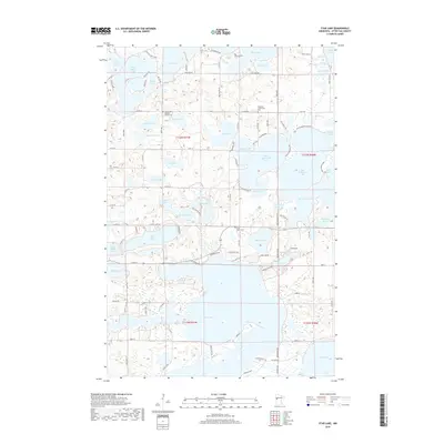
2019 Map of Star Lake
USGS Topo · Published 2019About this map
Star Lake dominates this central portion of Otter Tail County, anchoring an intricate network of glacial lakes and wetlands. The landscape is defined by its recreation-heavy shoreline development, with numerous private drives like Wrigley Cir and Shenandoah Loop providing access to seasonal and year-round residences. For genealogists and local historians, several landmarks offer points of interest, including the Sacred Heart Catholic Church Cem and the Weimann Community Cem. The map illustrates a high density of water bodies, from the larger West McDonald Lake and Big McDonald Lake to smaller, distinct basins like Alice Lake and Ottos Lake. The road network, including Co Hwy 35 and Co Hwy 41, reflects the area's transition into a more developed lakefront community while maintaining its legacy of rural churchyards and family-named cemeteries such as Saint Johns Cem.
Find a feature on this map
107 named features on this map. Tap any name to fly to it.
Don’t see what you’re looking for? This feature index may not catch every label — zoom into the map to look around manually.
Map Details
Editions of this 2019 Star Lake Map
This is the sole edition of this map. No revisions or reprints were ever made.
Other maps of this area

1912 · Vergas
USGS Topo · 1:62,500

1912 · Battle Lake
USGS Topo · 1:62,500

1914 · Battle Lake
USGS Topo · 1:62,500

1915 · Underwood
USGS Topo · 1:62,500

1915 · Perham
USGS Topo · 1:62,500

1915 · Vergas
USGS Topo · 1:62,500

1953 · Brainerd
USGS Topo · 1:250,000

1957 · Brainerd
USGS Topo · 1:250,000

1958 · Brainerd
USGS Topo · 1:250,000

1965 · Brainerd
USGS Topo · 1:250,000