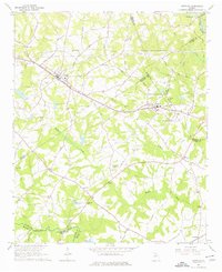
1964 Map of Statham
USGS Topo · Published 1976About this map
Statham and Bogart serve as the primary rail-oriented hubs in this mid-1960s portrait of north-central Georgia, positioned along the Seaboard Air Line corridor. The landscape is characterized by a high density of rural institutions that offer significant value for genealogical research, including family-named sites like Peppers Cemetery and Millsaps Cemetery. Further south, the rural character deepens along the Apalachee River, where historical industry and education are represented by Caruthers Mill and the nearby Caruthers School. The map captures a complex network of county boundaries where Barrow, Oconee, Clarke, Jackson, and Walton all meet, reflected in the varied placement of community anchors like Bethabara Church and Mt Zion Cemetery Church. Numerous secondary roads such as Dooley Town Road and Kinney Rat Road weave between the tributaries of Barber Creek and Bear Creek, illustrating the settlement patterns of these Piedmont ridges.
Find a feature on this map
64 named features on this map. Tap any name to fly to it.
Don’t see what you’re looking for? This feature index may not catch every label — zoom into the map to look around manually.
Map Details
Editions of this 1964 Statham Map
4 editions found
Other maps of this area

1891 · Gainesville
USGS Topo · 1:125,000

1891 · Carnesville
USGS Topo · 1:125,000

1896 · Monroe
USGS Topo · 1:125,000

1953 · Athens
USGS Topo · 1:250,000

1954 · Greenville
USGS Topo · 1:250,000

1958 · Greenville
USGS Topo · 1:250,000

1958 · Athens
USGS Topo · 1:250,000

1959 · Athens
USGS Topo · 1:250,000

1963 · Athens
USGS Topo · 1:250,000

1964 · Athens West
USGS Topo · 1:24,000