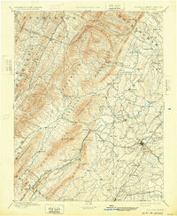
1894 Map of Staunton
USGS Topo · Published 1932About this map
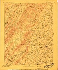
Staunton serves as the primary hub of this late 19th-century landscape, where the B. & O. R. R. and C. & O. R. R. converge amidst the sharp topography of the Shenandoah Valley. The map documents a transition from industrial operations like the Virginia Clay Works to the leisure culture of the era, seen in prominent resort locations such as Augusta Wh. Sulphur Springs, Stribling Spgs., and Variety Springs.
Find a feature on this map
128 named features on this map. Tap any name to fly to it.
Don’t see what you’re looking for? This feature index may not catch every label — zoom into the map to look around manually.
Map Details
Editions of this 1894 Staunton Map
8 editions found
Other maps of this area

1889 · Beverly
USGS Topo · 1:125,000

1892 · Beverly
USGS Topo · 1:125,000

1892 · Buckingham
USGS Topo · 1:125,000

1892 · Franklin
USGS Topo · 1:125,000

1892 · Woodstock
USGS Topo · 1:125,000

1892 · Harrisonburg
USGS Topo · 1:125,000

1894 · Staunton
USGS Topo · 1:125,000

1894 · Natural Bridge
USGS Topo · 1:125,000

1894 · Lexington
USGS Topo · 1:125,000

1896 · Franklin
USGS Topo · 1:125,000