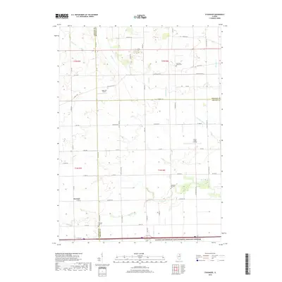
2018 Map of Stavanger
USGS Topo · Published 2018About this map
Stavanger and the surrounding rural landscapes of Grundy, LaSalle, and Kendall Counties are defined by a grid of agricultural roads and the meandering paths of several waterways. The settlement of Stavanger is anchored by its local history, evidenced by the Stavanger Lutheran Cem located nearby. Further east, Nettle Creek Landings provides a point of interest along the banks of Nettle Cr, which winds through the center of this terrain alongside Roods Cr and the E Fork Nettle Cr.
Find a feature on this map
54 named features on this map. Tap any name to fly to it.
Don’t see what you’re looking for? This feature index may not catch every label — zoom into the map to look around manually.
Map Details
Editions of this 2018 Stavanger Map
This is the sole edition of this map. No revisions or reprints were ever made.
Other maps of this area

1892 · Morris
USGS Topo · 1:62,500

1892 · Marseilles
USGS Topo · 1:62,500

1916 · Marseilles
USGS Topo · 1:62,500

1918 · Morris
USGS Topo · 1:62,500

1925 · Yorkville
USGS Topo · 1:62,500

1940 · Marseilles
USGS Topo · 1:62,500

1948 · Sandwich
USGS Topo · 1:62,500

1950 · Sandwich
USGS Topo · 1:62,500

1953 · Morris
USGS Topo · 1:24,000

1953 · Plattville
USGS Topo · 1:24,000