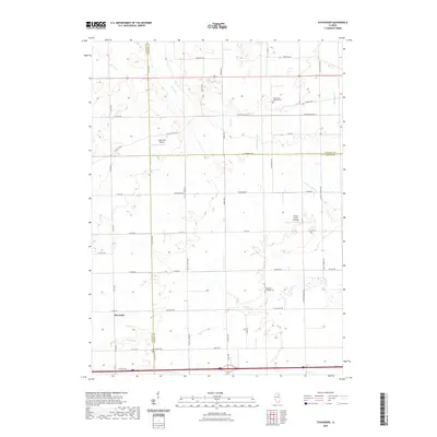
2021 Map of Stavanger
USGS Topo · Published 2021About this map
Stavanger and the surrounding agricultural lands of Grundy, LaSalle, and Kendall counties are defined by a network of drainage creeks and rural landmarks. The landscape is primarily shaped by the winding paths of Nettle Cr and its tributaries, including E Fork Nettle Cr and Roods Cr. For those researching local family histories, the area is home to several well-documented burial grounds, such as the West Lisbon Lutheran Cem and Holderman and Hoge Cem. These sites, along with the Stavanger Cem, offer tangible connections to the early settlement of Nettle Creek Township. Small-scale infrastructure like Vogen RLA Airport and the development at Nettle Creek Landings indicate the modern character of this prairie landscape, while the strict grid of rural roads like White Willow Rd and W Minooka Rd reflects the enduring impact of the Public Land Survey System.
Find a feature on this map
37 named features on this map. Tap any name to fly to it.
Don’t see what you’re looking for? This feature index may not catch every label — zoom into the map to look around manually.
Map Details
Editions of this 2021 Stavanger Map
This is the sole edition of this map. No revisions or reprints were ever made.
Other maps of this area

1892 · Morris
USGS Topo · 1:62,500

1892 · Marseilles
USGS Topo · 1:62,500

1916 · Marseilles
USGS Topo · 1:62,500

1918 · Morris
USGS Topo · 1:62,500

1925 · Yorkville
USGS Topo · 1:62,500

1940 · Marseilles
USGS Topo · 1:62,500

1948 · Sandwich
USGS Topo · 1:62,500

1950 · Sandwich
USGS Topo · 1:62,500

1953 · Morris
USGS Topo · 1:24,000

1953 · Plattville
USGS Topo · 1:24,000