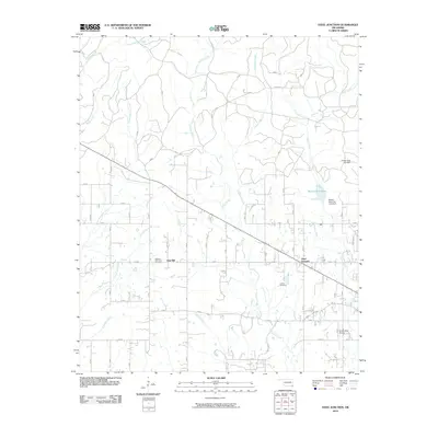
2010 Map of Steel Junction
USGS Topo · Published 2010About this map
Steel Junction and the community of Oak Hill anchor this 2010 survey of McCurtain County, Oklahoma. The landscape is defined by the significant hydraulic infrastructure supporting the region, including the Broken Bow City Dam and Broken Bow City Lake Dam which regulate the southern reaches of Broken Bow Lake. The terrain is deeply carved by a dense network of waterways like Lukfata Creek, Yashau Creek, and Courthouse Creek, illustrating the drainage patterns that have shaped local settlement and land use. For those tracing family history, the map precisely locates Watsons Memorial Cemetery and Lukfata Cemetery, providing essential geographic context for rural Oklahoma genealogy. The map also includes the Broken Bow Airport, showing the intersection of traditional creek-fed agriculture and modern transportation infrastructure.
Find a feature on this map
19 named features on this map. Tap any name to fly to it.
Don’t see what you’re looking for? This feature index may not catch every label — zoom into the map to look around manually.
Map Details
Editions of this 2010 Steel Junction Map
This is the sole edition of this map. No revisions or reprints were ever made.
Other maps of this area

1902 · Lukfata
USGS Topo · 1:125,000

1950 · Mcalester
USGS Topo · 1:250,000

1950 · Idabel
USGS Topo · 1:24,000

1950 · Shults
USGS Topo · 1:24,000

1951 · Idabel
USGS Topo · 1:24,000

1951 · Garvin
USGS Topo · 1:24,000

1951 · Shults
USGS Topo · 1:24,000

1953 · Texarkana
USGS Topo · 1:250,000

1956 · Texarkana
USGS Topo · 1:250,000

1959 · Golden
USGS Topo · 1:62,500