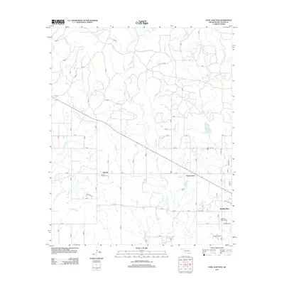
2012 Map of Steel Junction
USGS Topo · Published 2012About this map
Steel Junction and Oak Hill anchor this rural McCurtain County landscape as it appeared in the early 21st century. The terrain is defined by a dense network of tributaries including Lukfata Cr, S Boktuklo Cr, and Courthouse Cr that drain south toward the outskirts of Broken Bow. These watercourses create a dissected landscape where timber and local transit routes intertwine. Cultural history is preserved at sites like Watsons Memorial Cem near Oak Hill and Lukfata Cem further south. The eastern edge of the survey reveals the expanding footprint of the city, including the Broken Bow Airport and the southern reaches of Broken Bow Lake. Modern infrastructure like Old US Hwy 70 and the grid of rural roads such as Sweet Home Rd show the transition from wilder creek bottoms to organized settlement patterns.
Find a feature on this map
50 named features on this map. Tap any name to fly to it.
Don’t see what you’re looking for? This feature index may not catch every label — zoom into the map to look around manually.
Map Details
Editions of this 2012 Steel Junction Map
This is the sole edition of this map. No revisions or reprints were ever made.
Other maps of this area

1902 · Lukfata
USGS Topo · 1:125,000

1950 · Mcalester
USGS Topo · 1:250,000

1950 · Idabel
USGS Topo · 1:24,000

1950 · Shults
USGS Topo · 1:24,000

1951 · Idabel
USGS Topo · 1:24,000

1951 · Garvin
USGS Topo · 1:24,000

1951 · Shults
USGS Topo · 1:24,000

1953 · Texarkana
USGS Topo · 1:250,000

1956 · Texarkana
USGS Topo · 1:250,000

1959 · Golden
USGS Topo · 1:62,500