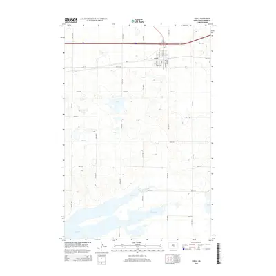
2014 Map of Steele
USGS Topo · Published 2014About this map
Steele serves as the focal point of this 2014 survey, situated at the intersection of several key regional routes including Nd-3 and Cr-10. The landscape is dominated by the expansive Long Lake, which stretches across the southern portion of the quadrangle, alongside other significant water bodies like Weber Lake and Alkali Lake. This era shows a well-defined grid of township roads such as 22nd Ave SE and 45th St SE, reflecting the agricultural parceling characteristic of the North Dakota plains. The detailed street network within the settlement of Steele, featuring thoroughfares like Mitchell Ave N and 1st St NW, highlights the town's role as a local hub for Kidder County residents and travelers moving along the regional highway corridors.
Find a feature on this map
29 named features on this map. Tap any name to fly to it.
Don’t see what you’re looking for? This feature index may not catch every label — zoom into the map to look around manually.
Map Details
Editions of this 2014 Steele Map
This is the sole edition of this map. No revisions or reprints were ever made.
Other maps of this area

1951 · Driscoll
USGS Topo · 1:62,500

1952 · Dawson
USGS Topo · 1:24,000

1952 · Steele NE
USGS Topo · 1:24,000

1952 · Steele
USGS Topo · 1:24,000

1952 · Steele NW
USGS Topo · 1:24,000

1953 · Jamestown
USGS Topo · 1:250,000

1954 · Bismarck
USGS Topo · 1:250,000

1956 · Jamestown
USGS Topo · 1:250,000

1958 · Bismarck
USGS Topo · 1:250,000

1975 · Lake Geneva
USGS Topo · 1:24,000