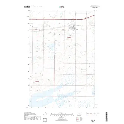
2017 Map of Steele
USGS Topo · Published 2017About this map
Steele serves as the focal point of this Kidder County landscape, positioned along the northern reaches of the map where a structured grid of local roads like Mitchell Ave N and 1st St NW defines the residential and commercial layout. The surrounding terrain is characterized by a significant concentration of prairie potholes and larger water bodies, including Weber Lake and the expansive waters of Long Lake and Alkali Lake to the southeast. These features reflect the post-glacial topography of the Missouri Coteau region, where internal drainage creates a complex system of wetlands. Local history is anchored by sites like Holy Cross Cem, while the historic route of Co Hwy 10 traces a legacy path through the region's agricultural heartland, paralleling the major transportation corridors that connect these rural communities.
Find a feature on this map
25 named features on this map. Tap any name to fly to it.
Don’t see what you’re looking for? This feature index may not catch every label — zoom into the map to look around manually.
Map Details
Editions of this 2017 Steele Map
This is the sole edition of this map. No revisions or reprints were ever made.
Other maps of this area

1951 · Driscoll
USGS Topo · 1:62,500

1952 · Dawson
USGS Topo · 1:24,000

1952 · Steele NE
USGS Topo · 1:24,000

1952 · Steele
USGS Topo · 1:24,000

1952 · Steele NW
USGS Topo · 1:24,000

1953 · Jamestown
USGS Topo · 1:250,000

1954 · Bismarck
USGS Topo · 1:250,000

1956 · Jamestown
USGS Topo · 1:250,000

1958 · Bismarck
USGS Topo · 1:250,000

1975 · Lake Geneva
USGS Topo · 1:24,000