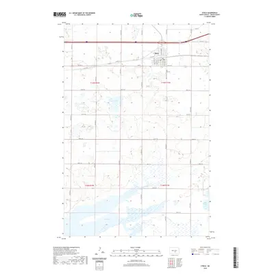
2020 Map of Steele
USGS Topo · Published 2020About this map
Steele serves as the central hub of this Kidder County landscape, situated where the grid of city streets like 1st ST NW and Mitchell Ave N meets the expansive prairie. The town's layout reflects a classic North Dakota settlement pattern, anchored by transportation routes such as Co Hwy 10 and proximity to local landmarks like Holy Cross Cem. Beyond the residential core, the topography is defined by a series of significant water bodies, including the wide reaches of Long Lake and the smaller Weber Lake and Alkali Lake. These features, alongside the systematic township and range divisions of t139n r73w and t138n r74w, illustrate the intersection of natural hydrology and the organized agricultural development of the region.
Find a feature on this map
30 named features on this map. Tap any name to fly to it.
Don’t see what you’re looking for? This feature index may not catch every label — zoom into the map to look around manually.
Map Details
Editions of this 2020 Steele Map
This is the sole edition of this map. No revisions or reprints were ever made.
Other maps of this area

1951 · Driscoll
USGS Topo · 1:62,500

1952 · Dawson
USGS Topo · 1:24,000

1952 · Steele NE
USGS Topo · 1:24,000

1952 · Steele
USGS Topo · 1:24,000

1952 · Steele NW
USGS Topo · 1:24,000

1953 · Jamestown
USGS Topo · 1:250,000

1954 · Bismarck
USGS Topo · 1:250,000

1956 · Jamestown
USGS Topo · 1:250,000

1958 · Bismarck
USGS Topo · 1:250,000

1975 · Lake Geneva
USGS Topo · 1:24,000