
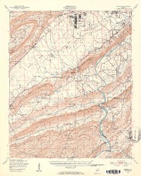
1947 Map of Steele
USGS Topo · Published 1953About this map
Camp Sibert occupies a significant portion of the landscape north of the Coosa River in this 1940s-era study. The river itself is a focal point of transit and industry, marked by Lock No 3 and several river crossings including Francis Ferry and the then-deactivated Steps Ferry and McCordney Ferry. To the north, the burgeoning outskirts of Gadsden are visible through developments like Clubview Heights and the Gadsden Municipal Airport.
Find a feature on this map
85 named features on this map. Tap any name to fly to it.
Don’t see what you’re looking for? This feature index may not catch every label — zoom into the map to look around manually.
Map Details
Editions of this 1947 Steele Map
2 editions found
Other maps of this area

1885 · Gadsden
USGS Topo · 1:125,000

1888 · Gadsden
USGS Topo · 1:125,000

1889 · Springville
USGS Topo · 1:125,000

1892 · Springville
USGS Topo · 1:125,000

1892 · Gadsden
USGS Topo · 1:125,000

1893 · Fort Payne
USGS Topo · 1:125,000

1895 · Gadsden
USGS Topo · 1:125,000

1898 · Fort Payne
USGS Topo · 1:125,000

1900 · Fort Payne
USGS Topo · 1:125,000

1900 · Anniston
USGS Topo · 1:125,000