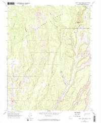
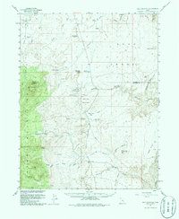
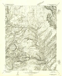
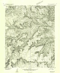
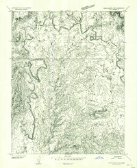
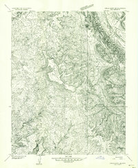
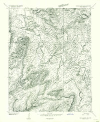
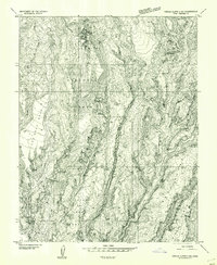
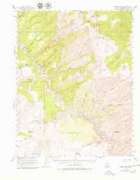
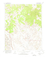
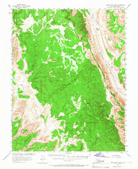
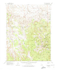
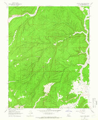
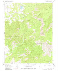
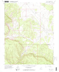
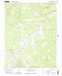
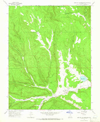
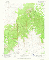
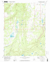
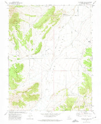
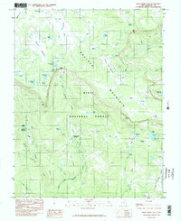
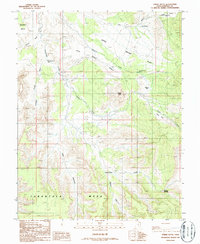
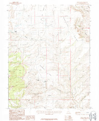
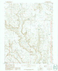
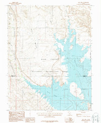
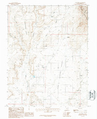
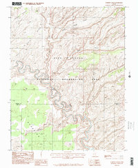
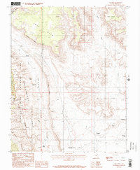
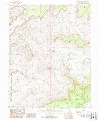
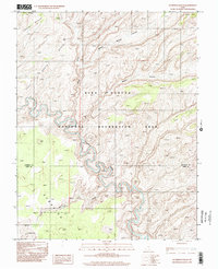
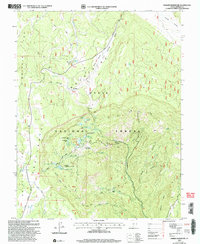
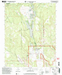
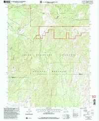
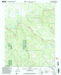
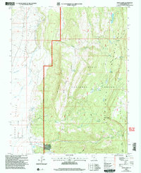
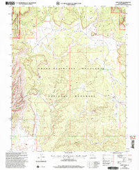
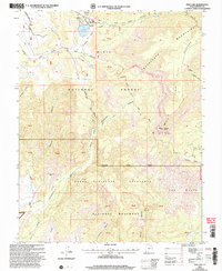
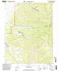
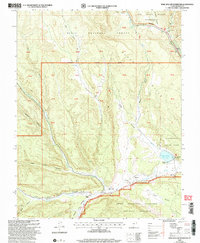
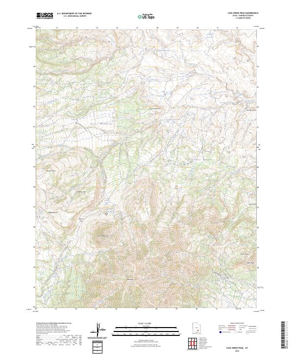
1964 Map of Steep Creek Bench
USGS Topo · Published 1974About this map
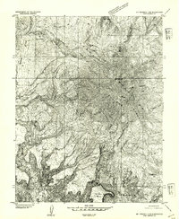
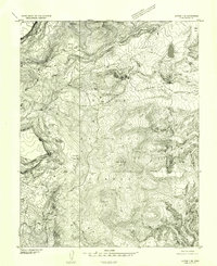
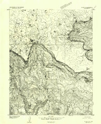
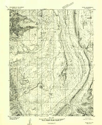
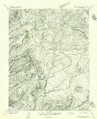
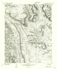
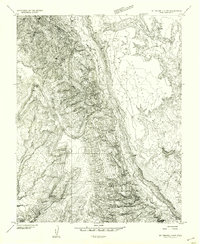
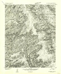
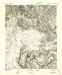
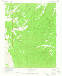
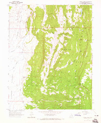
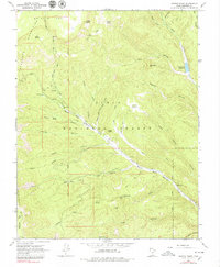
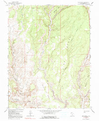
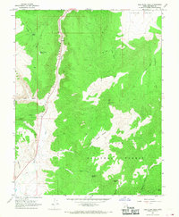
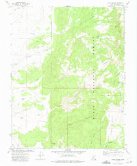
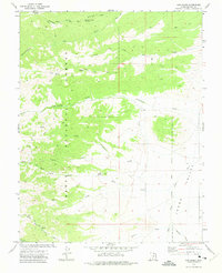
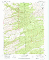
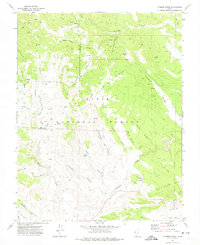
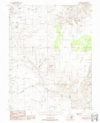
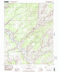
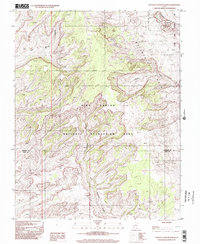
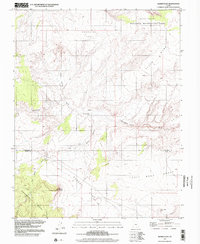
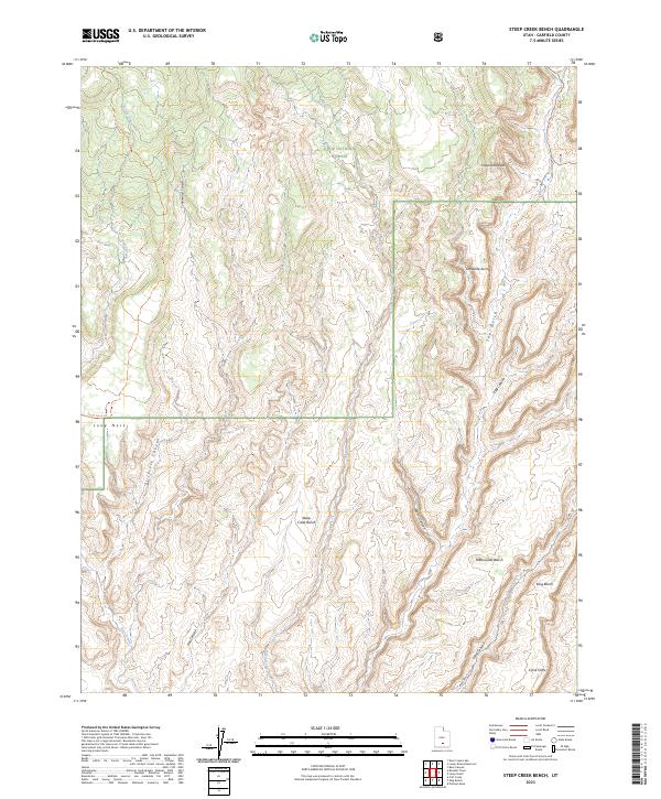
Dixie National Forest defines the northern reaches of this landscape, where the high terrain of Steep Creek Bench transitions into a complex system of drainage and erosion. The map documents a period when access was primarily limited to primitive infrastructure, indicated by a network of Pack Trails and Jeep Trails that negotiate the broken canyon country. To the north, the elevation culminates at Impossible Peak, while the southern portion of the quadrangle reveals the dramatic formations of the Circle Cliffs. Evidence of early cattle or seasonal occupation appears at the Long Neck Cabin, positioned near the Long Neck ridge. The hydrology of the area is defined by intermittent flows through deep incisions like Cottonwood Canyon, Slickrock Canyon, and the winding path of The Gulch, illustrating the erosive forces that shaped the Long Bench and Rattlesnake Gulch.
Find a feature on this map
25 named features on this map. Tap any name to fly to it.
Don’t see what you’re looking for? This feature index may not catch every label — zoom into the map to look around manually.
Map Details
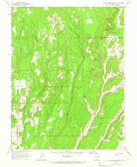
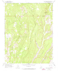
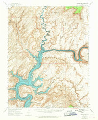
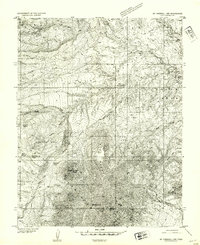
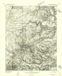
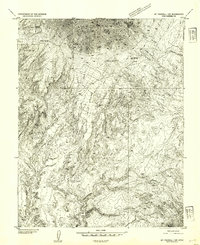
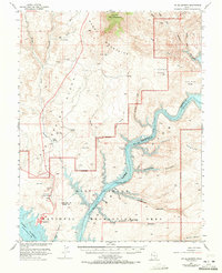
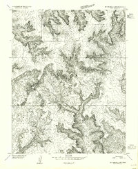
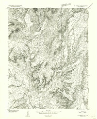
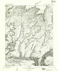
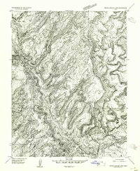
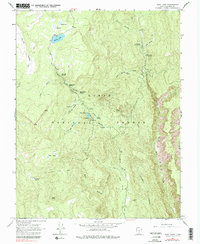
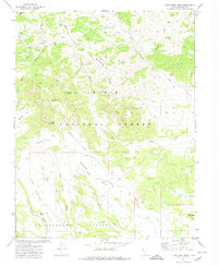
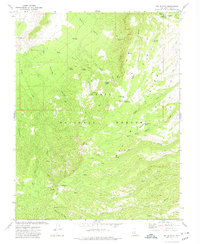
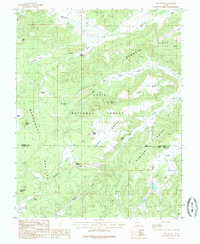
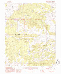
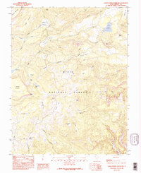
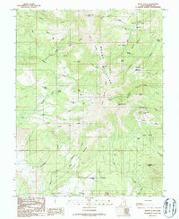
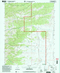
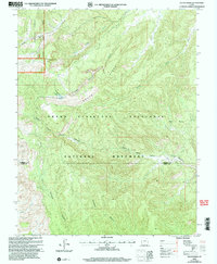
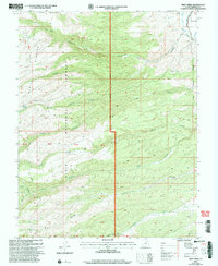
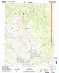
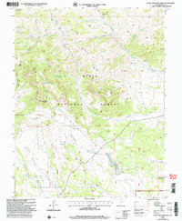
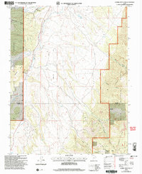
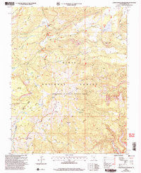
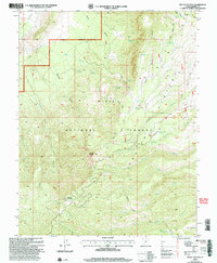
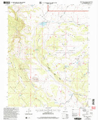
Editions of this 1964 Steep Creek Bench Map
3 editions found
Historical Maps of Garfield County Through Time
249 maps found
1952 Browns Rim
Garfield County, UT
1952 Bull Mountain
Garfield County, UT
1952 Grover
Garfield County, UT
1952 Mount Ellen 4 SW
Garfield County, UT
1952 Mt Hillers
Garfield County, UT
1952 Mt Pennell 1 NE
Garfield County, UT
1952 Mt Pennell 1 NW
Garfield County, UT
1952 Mt Pennell 1 SE
Garfield County, UT
1952 Mt Pennell 1 SW
Garfield County, UT
1952 Mt Pennell 2 NE
Garfield County, UT
1952 Notom 3 SE
Garfield County, UT
1952 Notom 3 SW
Garfield County, UT
1952 Notom 4 SE
Garfield County, UT
1952 Notom 4 SW
Garfield County, UT
1952 Notom
Garfield County, UT
1952 Orange Cliffs 3 SW
Garfield County, UT
1953 Circle Cliffs 1 NE
Garfield County, UT
1953 Circle Cliffs 1 NW
Garfield County, UT
1953 Circle Cliffs 1 SE
Garfield County, UT
1953 Circle Cliffs 1 SW
Garfield County, UT
1953 Circle Cliffs 2 NE
Garfield County, UT
1953 Circle Cliffs 4 NE
Garfield County, UT
1953 Circle Cliffs 4 NW
Garfield County, UT
1953 Circle Cliffs 4 SW
Garfield County, UT
1953 Fiddler Butte
Garfield County, UT

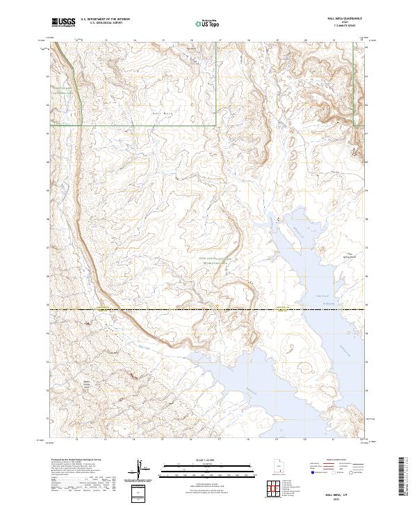
1953 Hall Mesa
Garfield County, UT
1953 Moody Creek
Garfield County, UT
1953 Mt. Ellsworth
Garfield County, UT
1953 Mt Pennell 2 NW
Garfield County, UT
1953 Mt Pennell 2 SE
Garfield County, UT
1953 Mt Pennell 2 SW
Garfield County, UT
1953 Mt Pennell 3 NW
Garfield County, UT
1953 Mt Pennell 3 SW
Garfield County, UT
1953 Mt Pennell 4 NE
Garfield County, UT
1953 Mt Pennell
Garfield County, UT
1953 Orange Cliffs 3 SE
Garfield County, UT
1953 Orange Cliffs 4 SW
Garfield County, UT
1953 Orange Cliffs
Garfield County, UT
1953 Wagon Box Mesa
Garfield County, UT
1954 White Canyon 2 NE
Garfield County, UT
1954 White Canyon 2 NW
Garfield County, UT
1958 Panguitch Lake
Garfield County, UT
1962 Mt. Ellen
Garfield County, UT
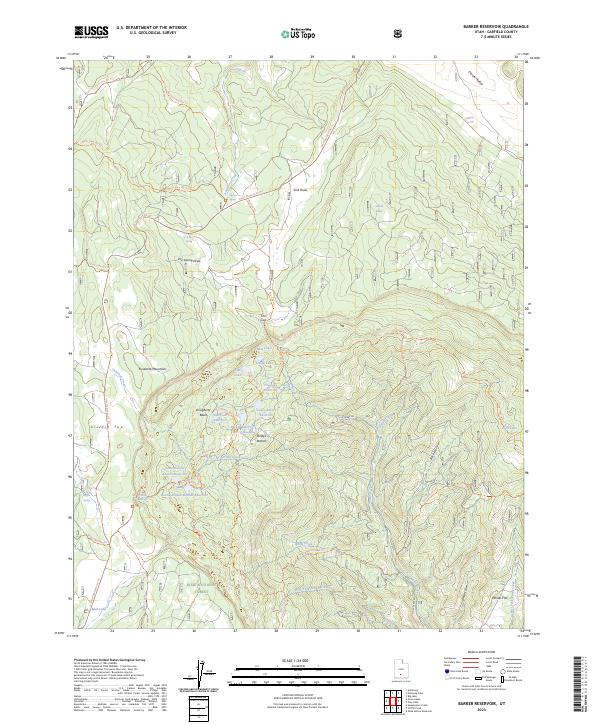
1964 Barker Reservoir
Garfield County, UT
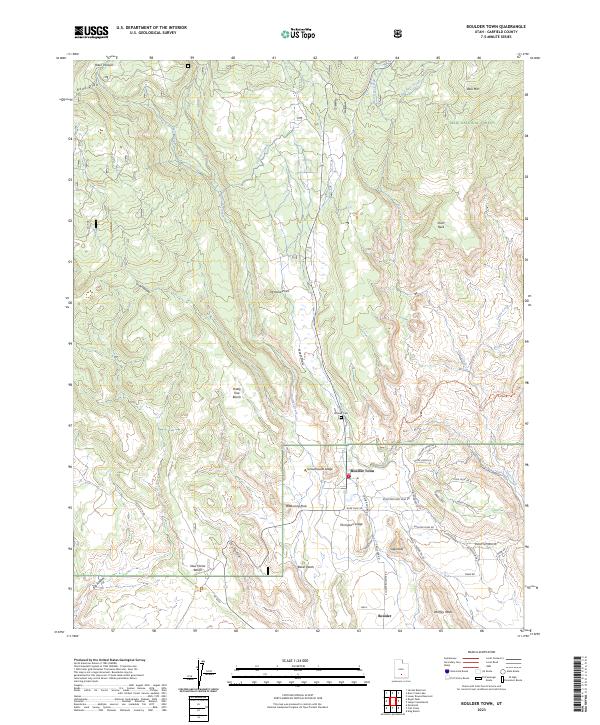
1964 Boulder Town
Garfield County, UT
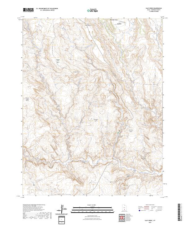
1964 Calf Creek
Garfield County, UT
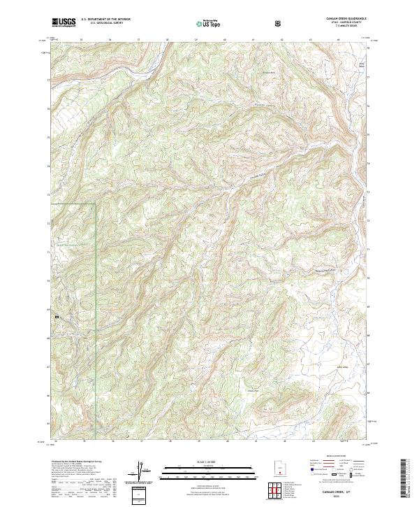
1964 Canaan Creek
Garfield County, UT
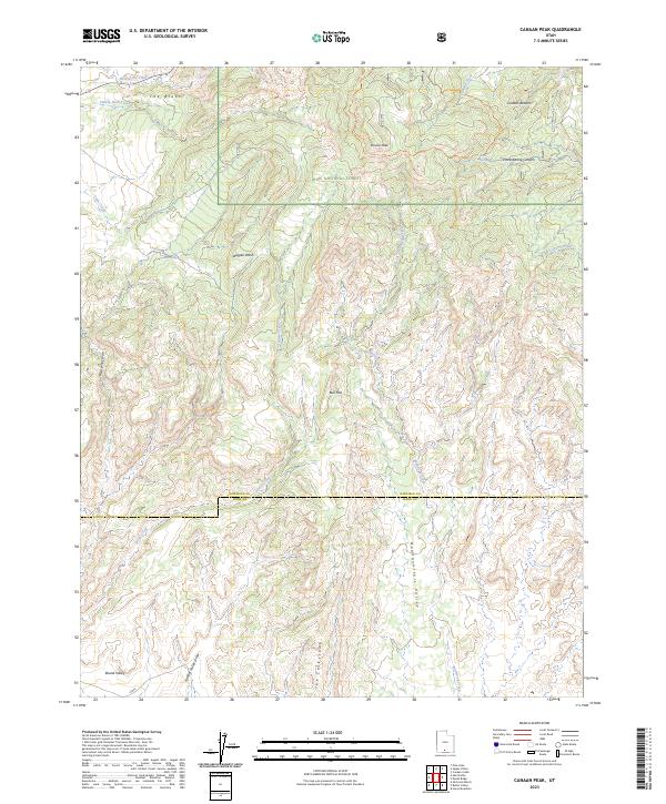
1964 Canaan Peak
Garfield County, UT
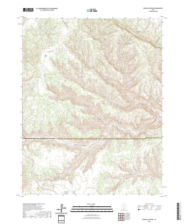
1964 Carcass Canyon
Garfield County, UT
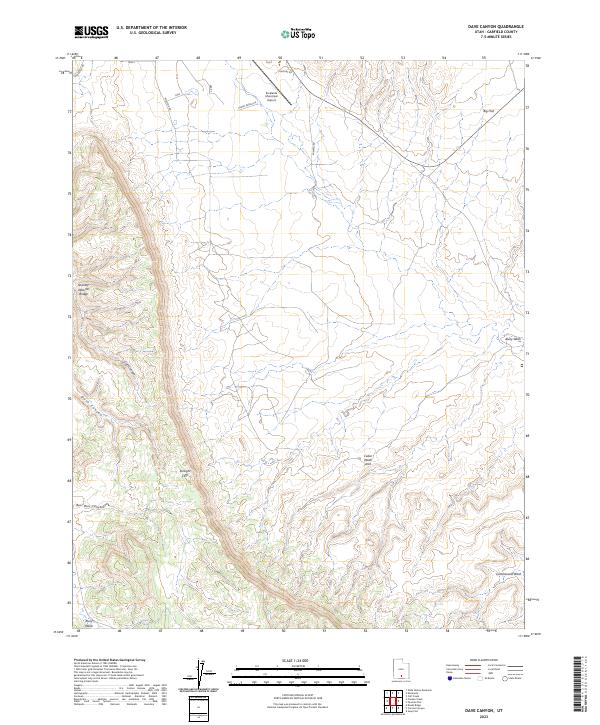
1964 Dave Canyon
Garfield County, UT
1964 Death Ridge
Garfield County, UT
1964 Grass Lakes
Garfield County, UT
1964 Griffin Point
Garfield County, UT
1964 King Bench
Garfield County, UT
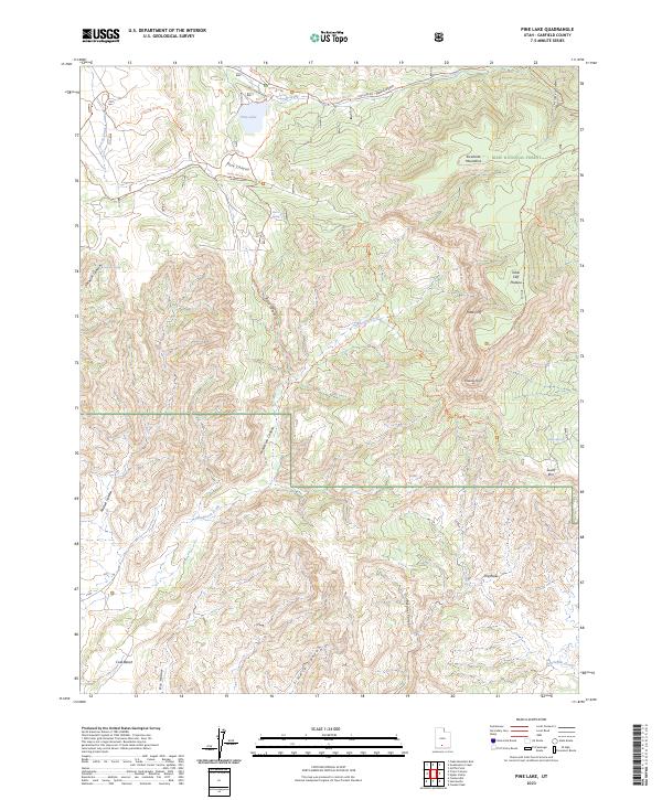
1964 Pine Lake
Garfield County, UT
1964 Posy Lake
Garfield County, UT
1964 Red Breaks
Garfield County, UT
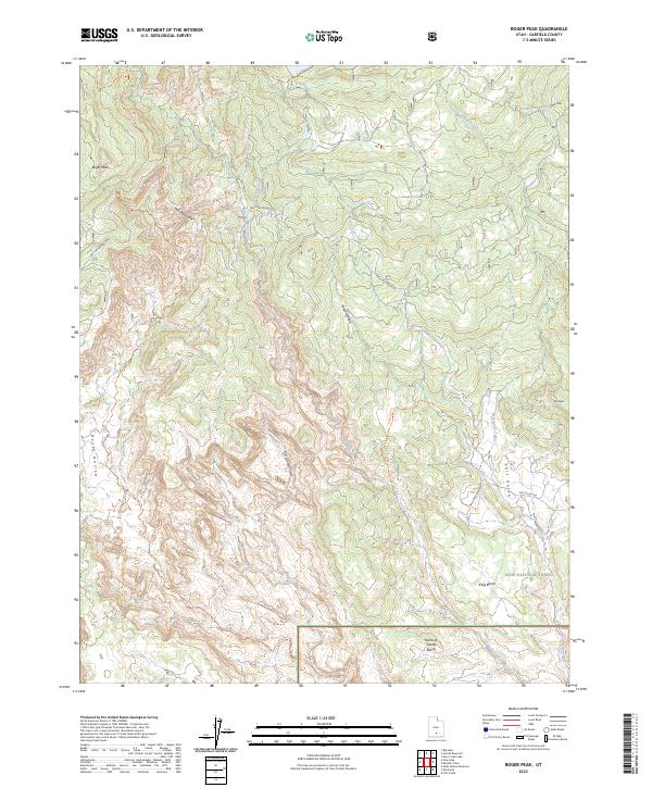
1964 Roger Peak
Garfield County, UT
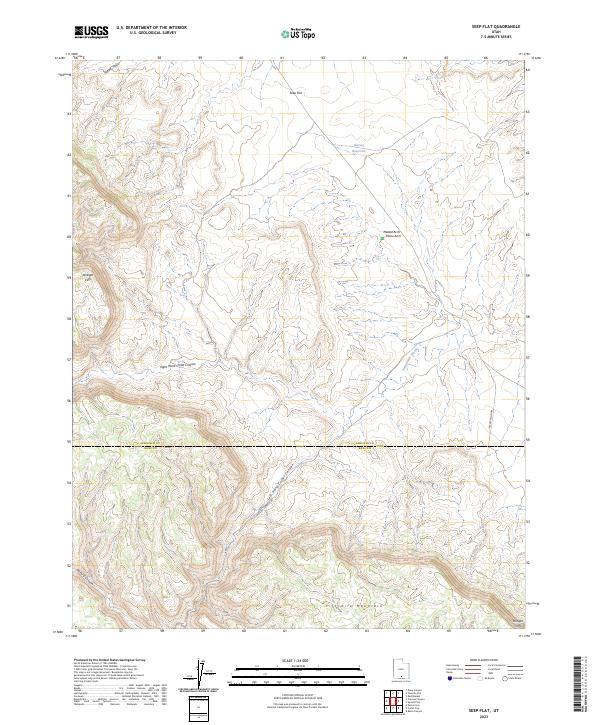
1964 Seep Flat
Garfield County, UT
1964 Steep Creek Bench
Garfield County, UT
1964 Sunset Flat
Garfield County, UT
1964 Sweetwater Creek
Garfield County, UT
1964 Tenmile Flat
Garfield County, UT
1964 Upper Valley
Garfield County, UT
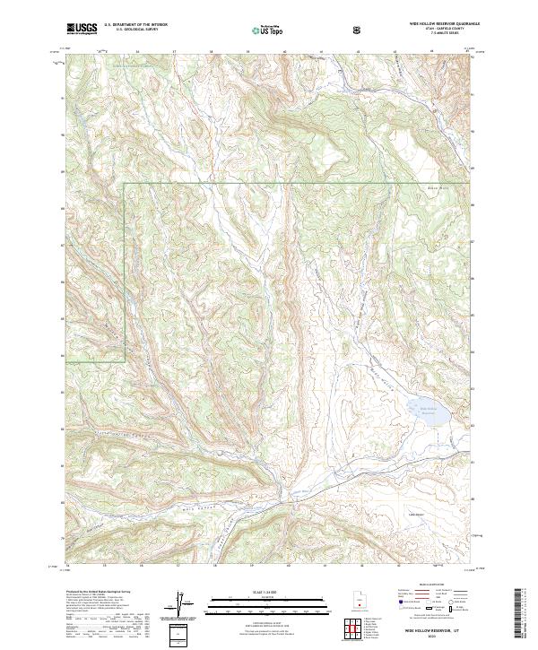
1964 Wide Hollow Reservoir
Garfield County, UT
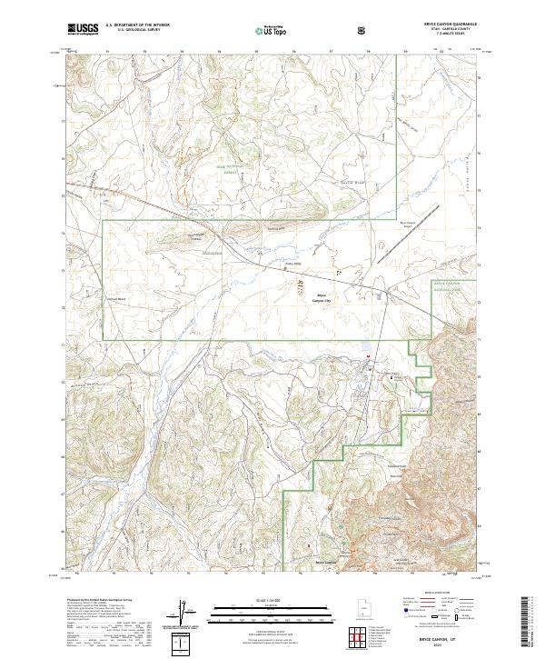
1966 Bryce Canyon
Garfield County, UT
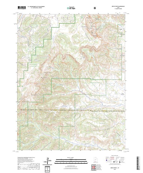
1966 Bryce Point
Garfield County, UT
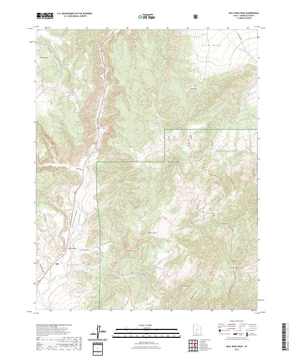
1966 Bull Rush Peak
Garfield County, UT
1966 Fremont Pass
Garfield County, UT
1966 George Mtn
Garfield County, UT
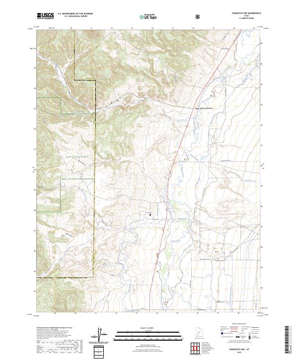
1966 Panguitch NW
Garfield County, UT
1966 Tropic Canyon
Garfield County, UT
1966 Tropic Reservoir
Garfield County, UT
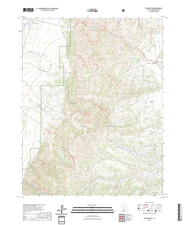
1966 Wilson Peak
Garfield County, UT
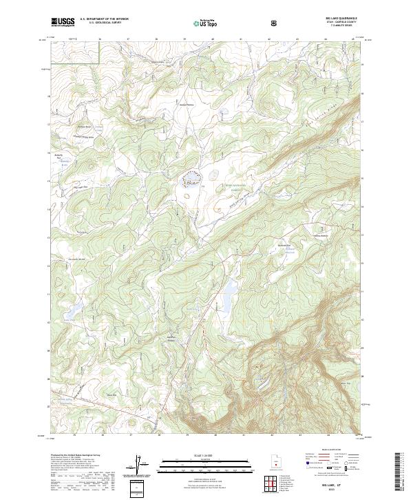
1969 Big Lake
Garfield County, UT
1969 Jacobs Reservoir
Garfield County, UT
1970 Pollywog Lake
Garfield County, UT
1971 Adams Head
Garfield County, UT
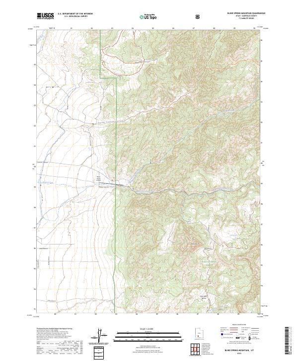
1971 Blind Spring Mtn
Garfield County, UT
1971 Casto Canyon
Garfield County, UT
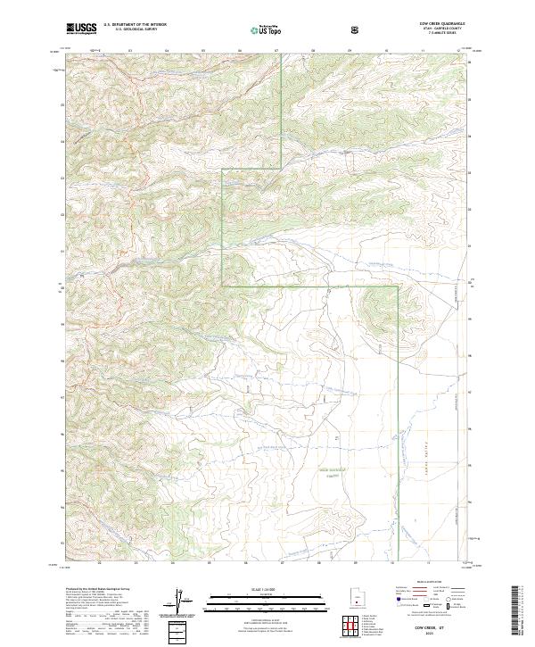
1971 Cow Creek
Garfield County, UT
1971 Deep Creek
Garfield County, UT
1971 Fivemile Ridge
Garfield County, UT
1971 Flake Mtn East
Garfield County, UT
1971 Flake Mtn West
Garfield County, UT
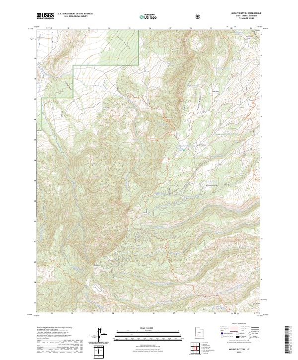
1971 Mt. Dutton
Garfield County, UT

1980 Hite Crossing
Garfield County, UT
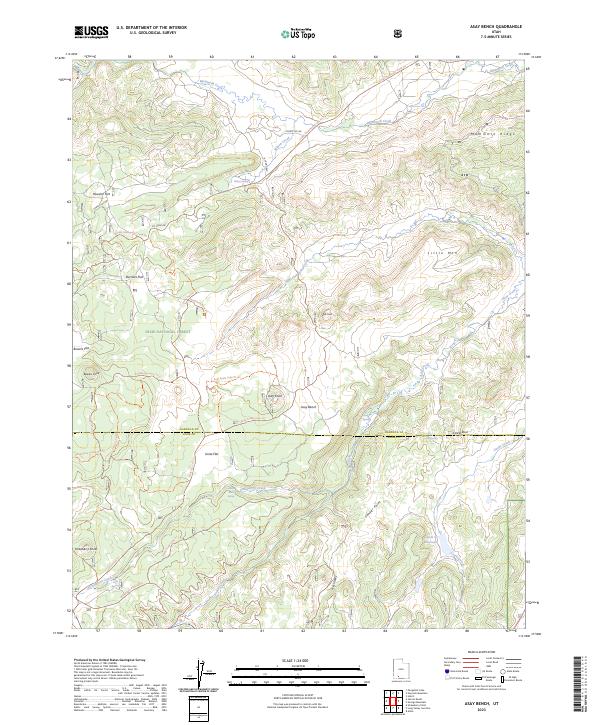
1985 Asay Bench
Garfield County, UT
1985 Deer Creek Lake
Garfield County, UT
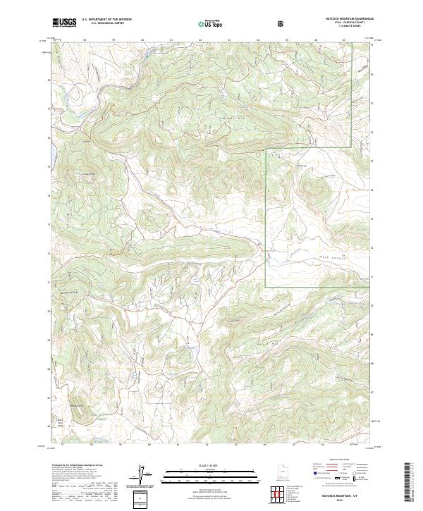
1985 Haycock Mountain
Garfield County, UT
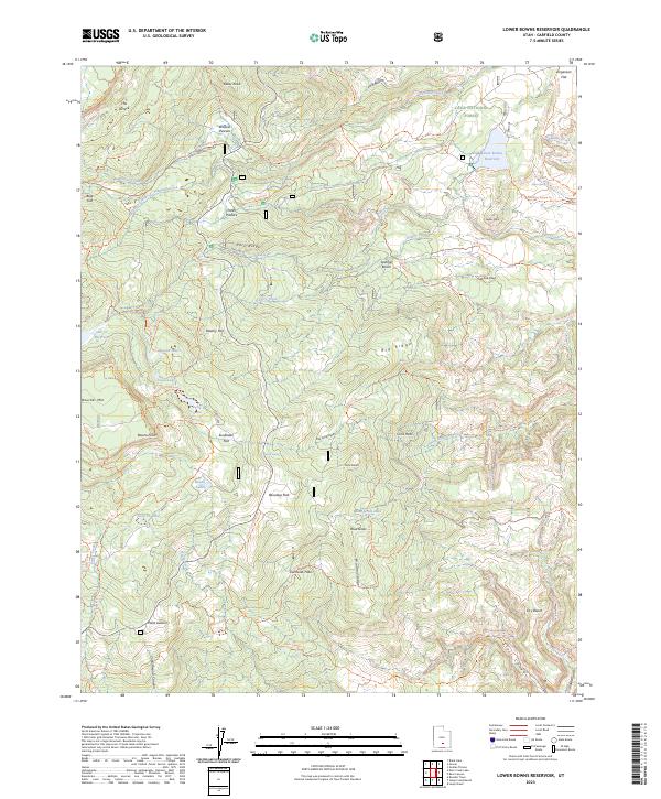
1985 Lower Bowns Reservoir
Garfield County, UT
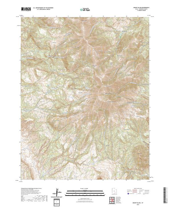
1986 Mount Ellen
Garfield County, UT
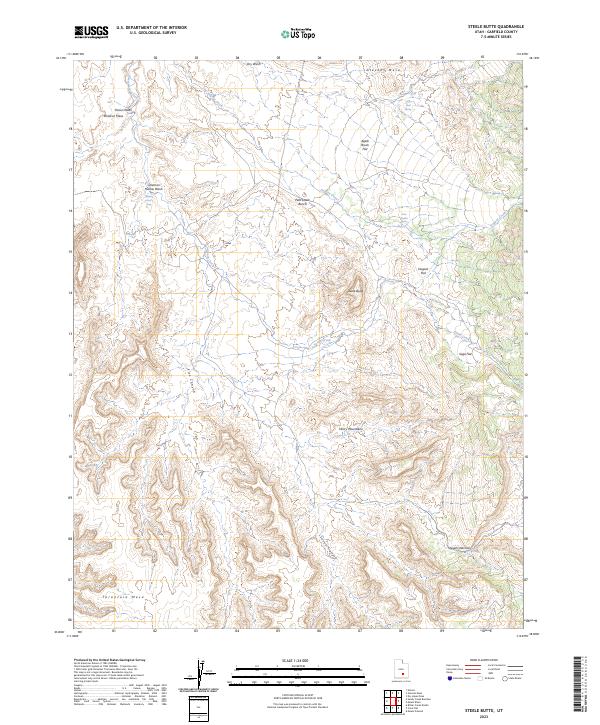
1986 Steele Butte
Garfield County, UT
1987 Ant Knoll
Garfield County, UT
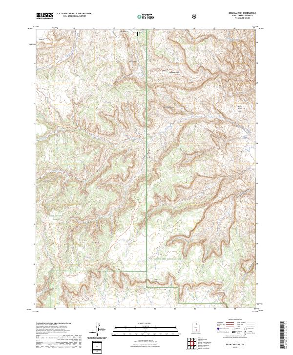
1987 Bear Canyon
Garfield County, UT
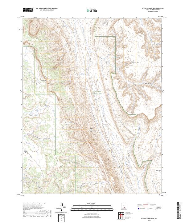
1987 Bitter Creek Divide
Garfield County, UT
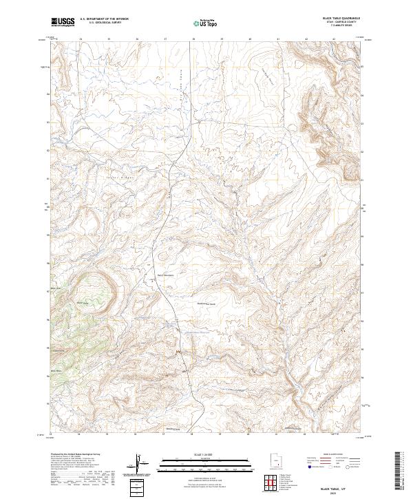
1987 Black Table
Garfield County, UT
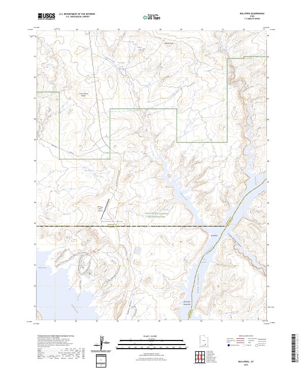
1987 Bullfrog
Garfield County, UT
1987 Cass Creek Peak
Garfield County, UT
1987 Cave Flat
Garfield County, UT
1987 Clay Point
Garfield County, UT
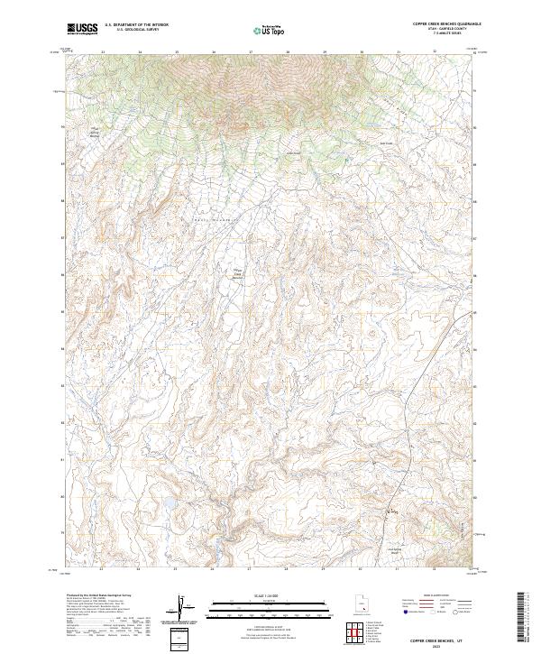
1987 Copper Creek Benches
Garfield County, UT
1987 Deer Point
Garfield County, UT
1987 Egypt
Garfield County, UT
1987 Hall Mesa
Garfield County, UT
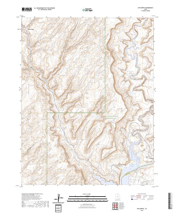
1987 Hite North
Garfield County, UT
1987 Horse Pasture Mesa
Garfield County, UT
1987 Lamp Stand
Garfield County, UT
1987 Lost Spring
Garfield County, UT

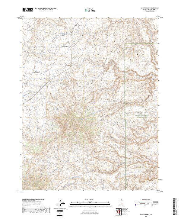
1987 Mount Holmes
Garfield County, UT
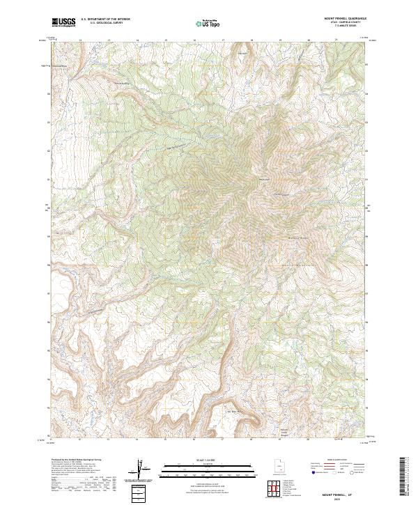
1987 Mount Pennell
Garfield County, UT
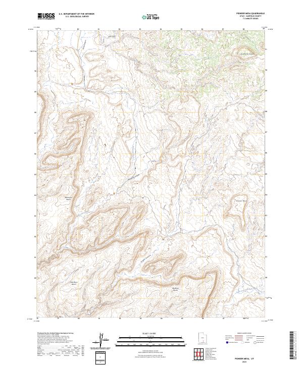
1987 Pioneer Mesa
Garfield County, UT
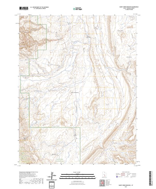
1987 Sandy Creek Benches
Garfield County, UT
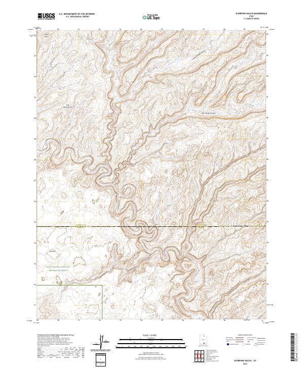
1987 Scorpion Gulch
Garfield County, UT
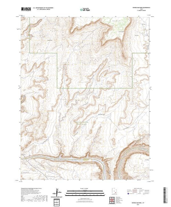
1987 Sewing Machine
Garfield County, UT
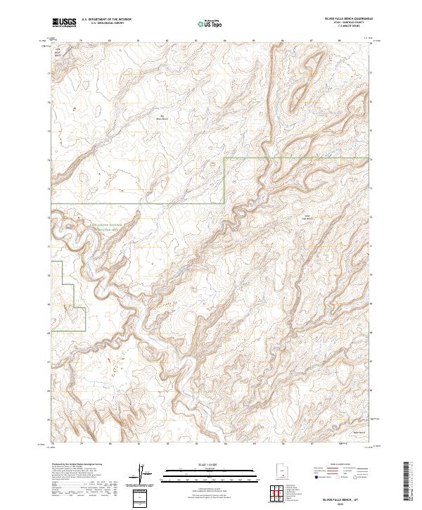
1987 Silver Falls Bench
Garfield County, UT
1987 Stevens Canyon North
Garfield County, UT
1987 The Post
Garfield County, UT
1987 Ticaboo Mesa
Garfield County, UT
1987 Wagon Box Mesa
Garfield County, UT
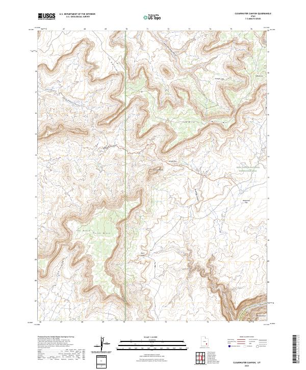
1988 Clearwater Canyon
Garfield County, UT
1988 Fiddler Butte
Garfield County, UT
1988 Raggy Canyon
Garfield County, UT
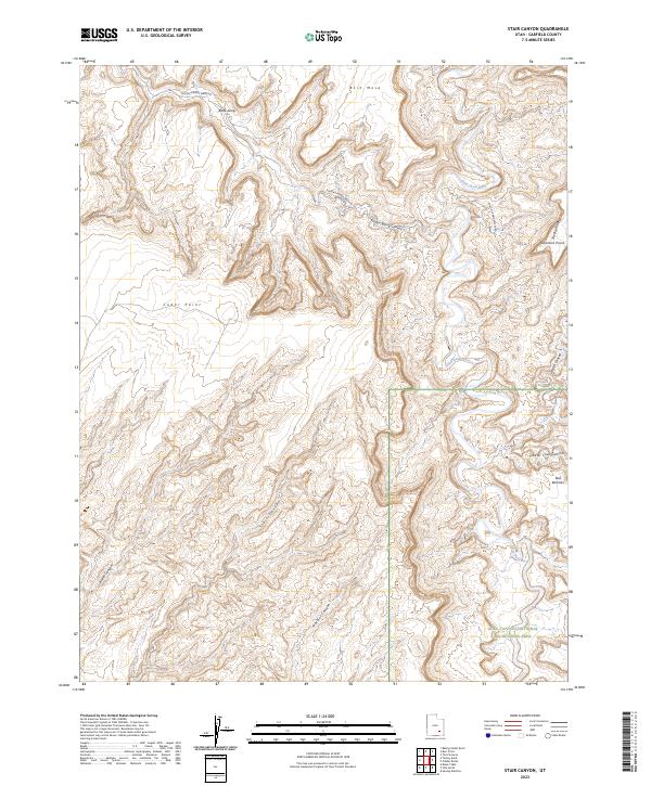
1988 Stair Canyon
Garfield County, UT
1988 Teapot Rock
Garfield County, UT
1988 Turkey Knob
Garfield County, UT
1997 Egypt
Garfield County, UT
1997 King Bench
Garfield County, UT
1997 Red Breaks
Garfield County, UT
1997 Scorpion Gulch
Garfield County, UT
1997 Silver Falls Bench
Garfield County, UT
1997 Stevens Canyon North
Garfield County, UT
1997 Sunset Flat
Garfield County, UT
2002 Barker Reservoir
Garfield County, UT
2002 Bear Canyon
Garfield County, UT
2002 Big Lake
Garfield County, UT
2002 Blind Spring Mountain
Garfield County, UT
2002 Boulder Town
Garfield County, UT
2002 Bryce Canyon
Garfield County, UT
2002 Bryce Point
Garfield County, UT
2002 Canaan Creek
Garfield County, UT
2002 Canaan Peak
Garfield County, UT
2002 Cow Creek
Garfield County, UT
2002 Death Ridge
Garfield County, UT
2002 Deep Creek
Garfield County, UT
2002 Deer Creek Lake
Garfield County, UT
2002 Fivemile Ridge
Garfield County, UT
2002 Flake Mountain West
Garfield County, UT
2002 George Mountain
Garfield County, UT
2002 Grass Lakes
Garfield County, UT
2002 Griffin Point
Garfield County, UT
2002 Haycock Mountain
Garfield County, UT
2002 Jacobs Reservoir
Garfield County, UT
2002 Lamp Stand
Garfield County, UT
2002 Lower Bowns Reservoir
Garfield County, UT
2002 Mount Dutton
Garfield County, UT
2002 Panguitch NW
Garfield County, UT
2002 Pine Lake
Garfield County, UT
2002 Pollywog Lake
Garfield County, UT
2002 Roger Peak
Garfield County, UT
2002 Steep Creek Bench
Garfield County, UT
2002 Sweetwater Creek
Garfield County, UT
2002 Tropic Canyon
Garfield County, UT
2002 Tropic Reservoir
Garfield County, UT
2002 Upper Valley
Garfield County, UT
2002 Wide Hollow Reservoir
Garfield County, UT
2002 Wilson Peak
Garfield County, UT
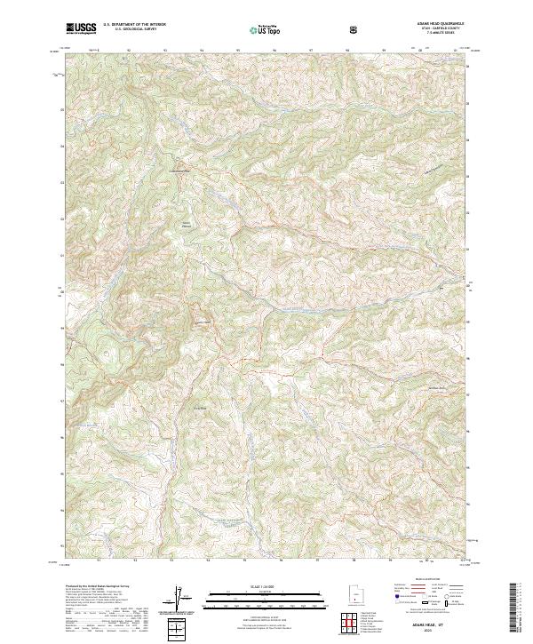
2023 Adams Head
Garfield County, UT
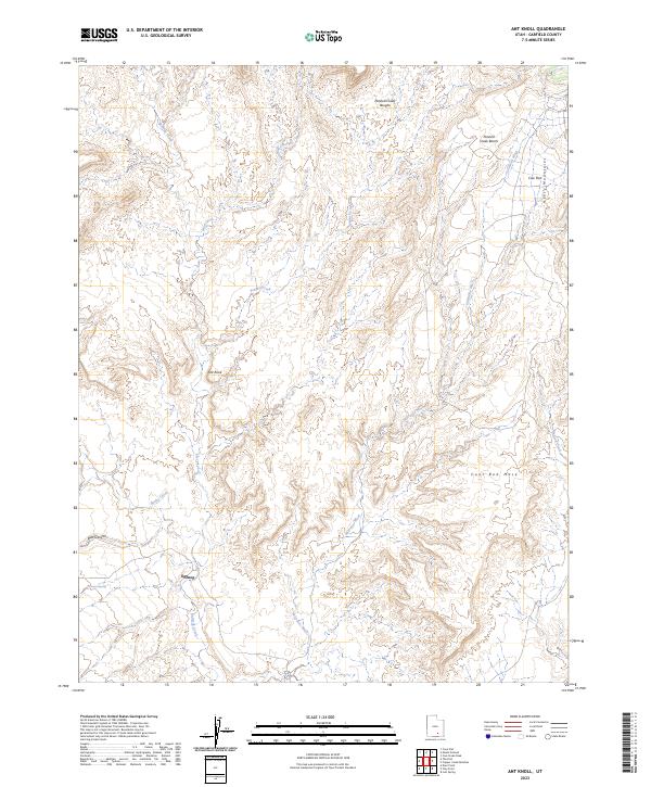
2023 Ant Knoll
Garfield County, UT
2023 Asay Bench
Garfield County, UT
2023 Barker Reservoir
Garfield County, UT
2023 Bear Canyon
Garfield County, UT
2023 Big Lake
Garfield County, UT
2023 Bitter Creek Divide
Garfield County, UT
2023 Black Table
Garfield County, UT
2023 Blind Spring Mountain
Garfield County, UT
2023 Boulder Town
Garfield County, UT
2023 Bryce Canyon
Garfield County, UT
2023 Bryce Point
Garfield County, UT
2023 Bullfrog
Garfield County, UT
2023 Bull Rush Peak
Garfield County, UT
2023 Calf Creek
Garfield County, UT
2023 Canaan Creek
Garfield County, UT
2023 Canaan Peak
Garfield County, UT
2023 Carcass Canyon
Garfield County, UT
2023 Cass Creek Peak
Garfield County, UT
2023 Casto Canyon
Garfield County, UT
2023 Cave Flat
Garfield County, UT
2023 Clay Point
Garfield County, UT
2023 Clearwater Canyon
Garfield County, UT
2023 Copper Creek Benches
Garfield County, UT
2023 Cow Creek
Garfield County, UT
2023 Dave Canyon
Garfield County, UT
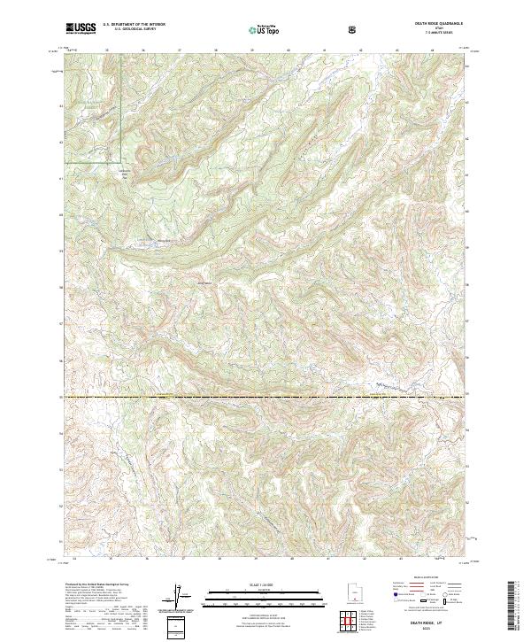
2023 Death Ridge
Garfield County, UT

2023 Deep Creek
Garfield County, UT
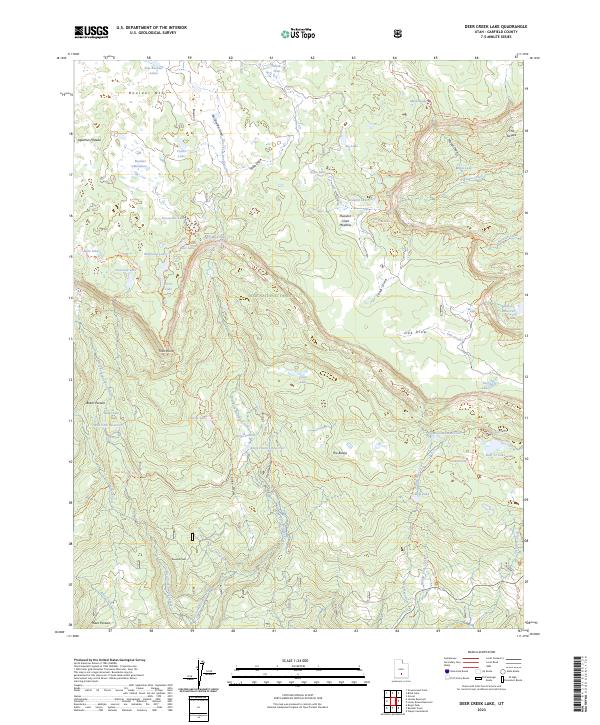
2023 Deer Creek Lake
Garfield County, UT
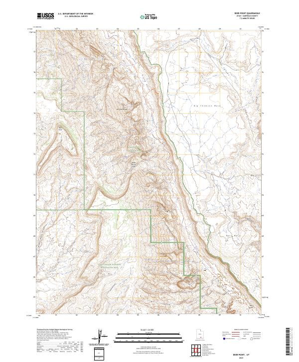
2023 Deer Point
Garfield County, UT
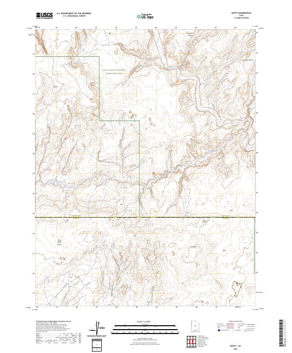
2023 Egypt
Garfield County, UT
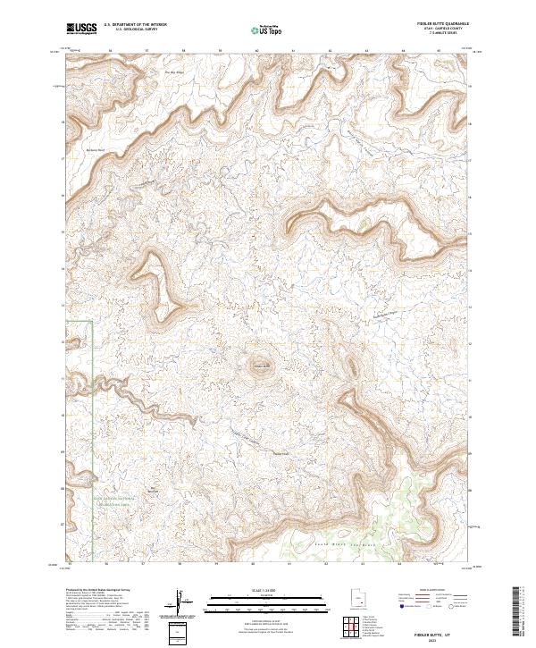
2023 Fiddler Butte
Garfield County, UT
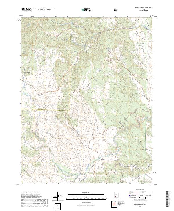
2023 Fivemile Ridge
Garfield County, UT
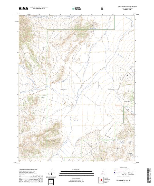
2023 Flake Mountain East
Garfield County, UT
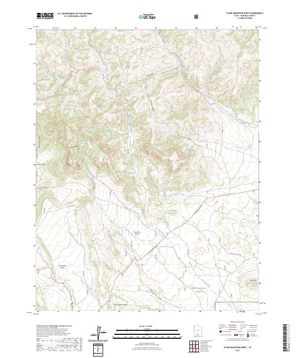
2023 Flake Mountain West
Garfield County, UT
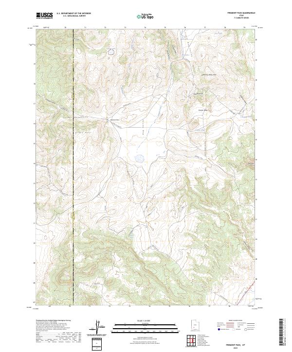
2023 Fremont Pass
Garfield County, UT
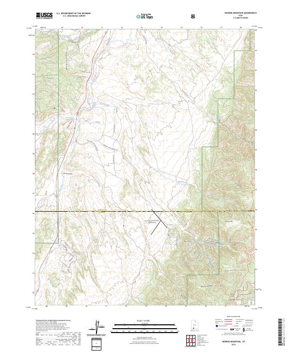
2023 George Mountain
Garfield County, UT
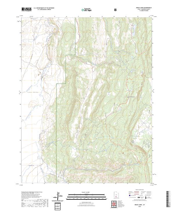
2023 Grass Lakes
Garfield County, UT
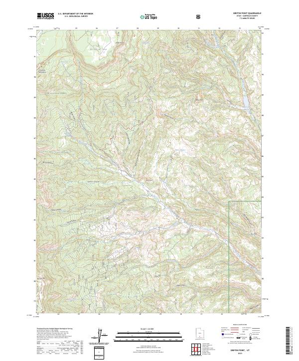
2023 Griffin Point
Garfield County, UT
2023 Hall Mesa
Garfield County, UT
2023 Haycock Mountain
Garfield County, UT
2023 Hite North
Garfield County, UT
2023 Horse Pasture Mesa
Garfield County, UT
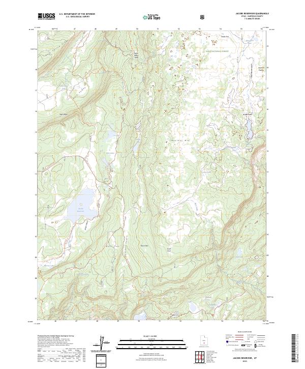
2023 Jacobs Reservoir
Garfield County, UT
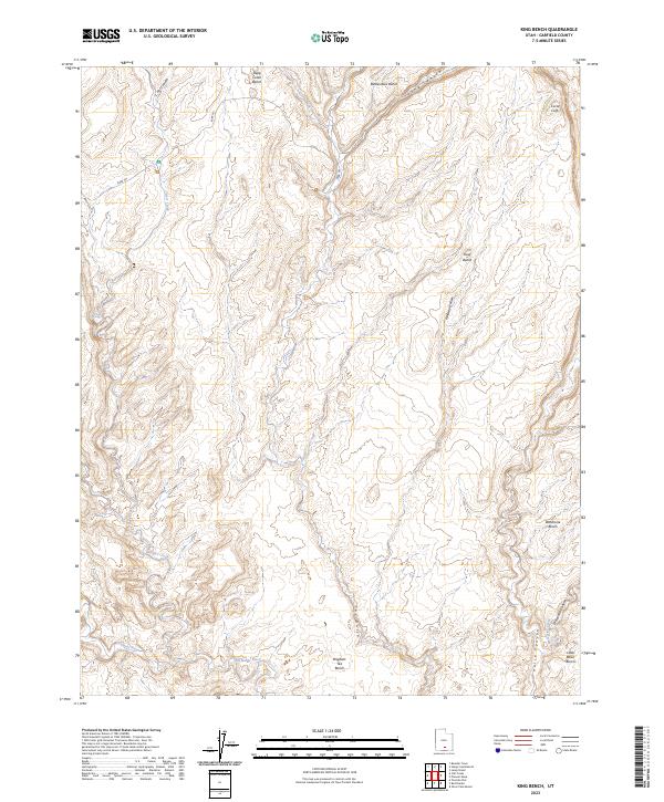
2023 King Bench
Garfield County, UT
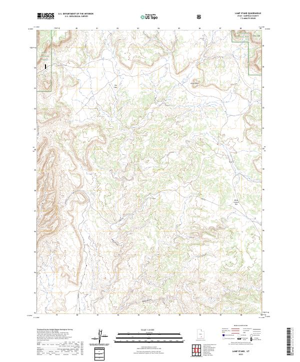
2023 Lamp Stand
Garfield County, UT
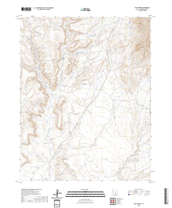
2023 Lost Spring
Garfield County, UT
2023 Lower Bowns Reservoir
Garfield County, UT
2023 Mount Dutton
Garfield County, UT
2023 Mount Ellen
Garfield County, UT
2023 Mount Holmes
Garfield County, UT
2023 Mount Pennell
Garfield County, UT
2023 Panguitch NW
Garfield County, UT
2023 Pine Lake
Garfield County, UT
2023 Pioneer Mesa
Garfield County, UT
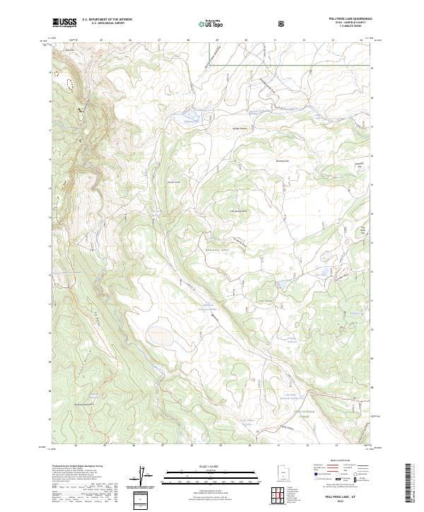
2023 Pollywog Lake
Garfield County, UT
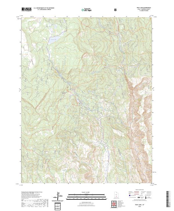
2023 Posy Lake
Garfield County, UT
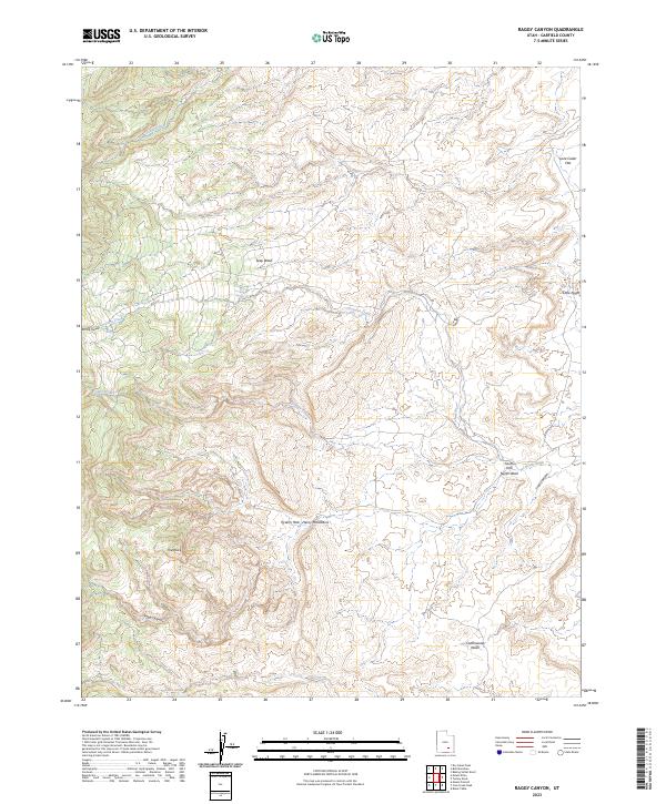
2023 Raggy Canyon
Garfield County, UT
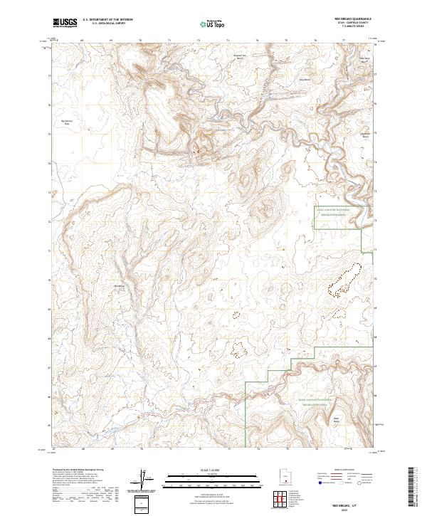
2023 Red Breaks
Garfield County, UT
2023 Roger Peak
Garfield County, UT
2023 Sandy Creek Benches
Garfield County, UT
2023 Scorpion Gulch
Garfield County, UT
2023 Seep Flat
Garfield County, UT
2023 Sewing Machine
Garfield County, UT
2023 Silver Falls Bench
Garfield County, UT
2023 Stair Canyon
Garfield County, UT
2023 Steele Butte
Garfield County, UT
2023 Steep Creek Bench
Garfield County, UT
2023 Stevens Canyon North
Garfield County, UT
2023 Sunset Flat
Garfield County, UT

2023 Sweetwater Creek
Garfield County, UT
2023 Teapot Rock
Garfield County, UT
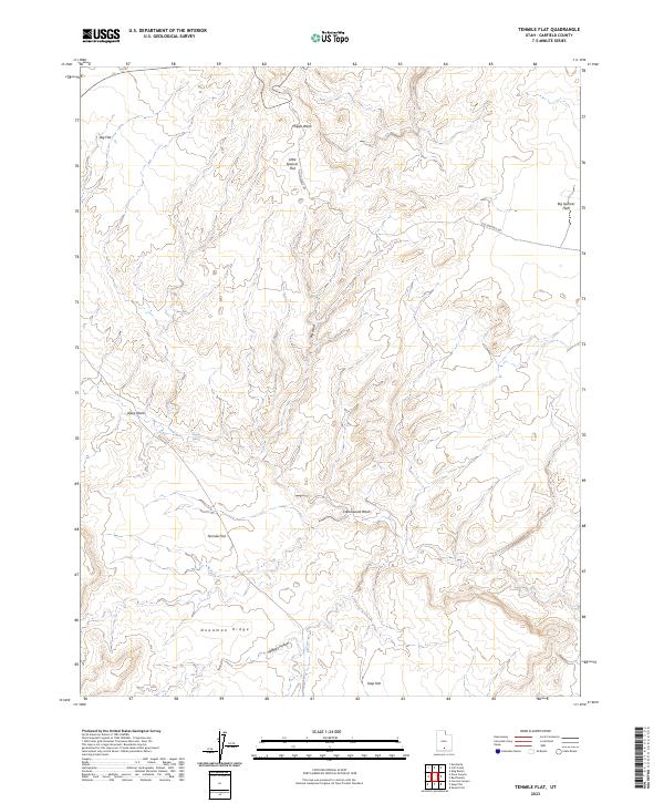
2023 Tenmile Flat
Garfield County, UT
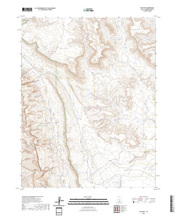
2023 The Post
Garfield County, UT
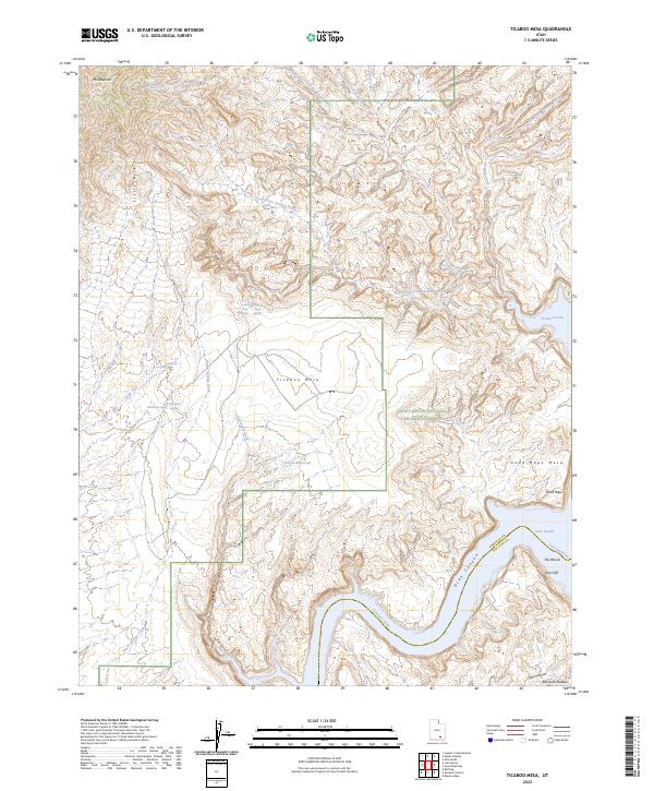
2023 Ticaboo Mesa
Garfield County, UT
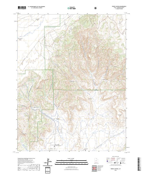
2023 Tropic Canyon
Garfield County, UT
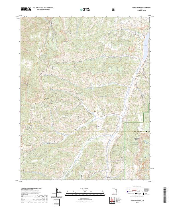
2023 Tropic Reservoir
Garfield County, UT
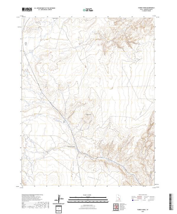
2023 Turkey Knob
Garfield County, UT
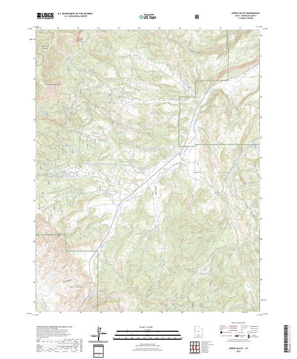
2023 Upper Valley
Garfield County, UT
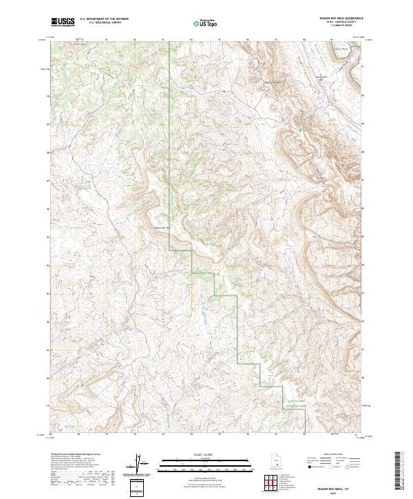
2023 Wagon Box Mesa
Garfield County, UT
2023 Wide Hollow Reservoir
Garfield County, UT
2023 Wilson Peak
Garfield County, UT