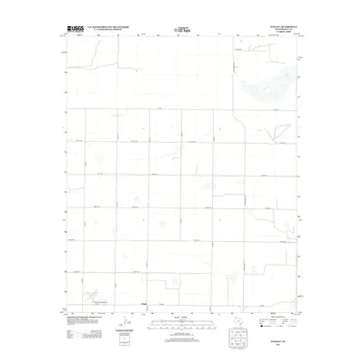
2012 Map of Stegall
USGS Topo · Published 2012About this map
Stegall and the surrounding plains of Bailey County are defined by a rhythmic grid of rural roads and the presence of numerous ephemeral depressions typical of the Llano Estacado. The settlement of Stegall serves as a small anchor in the southwestern portion of the map, situated at the junction of Fm-298 and several local county roads. To the northeast, the sprawling bed of Coyote Lake provides a stark contrast to the surrounding farmland, representing a significant alkaline wetland feature in this high plains environment.
Find a feature on this map
18 named features on this map. Tap any name to fly to it.
Don’t see what you’re looking for? This feature index may not catch every label — zoom into the map to look around manually.
Map Details
Editions of this 2012 Stegall Map
This is the sole edition of this map. No revisions or reprints were ever made.
Other maps of this area

1954 · Clovis
USGS Topo · 1:250,000

1954 · Brownfield
USGS Topo · 1:250,000

1957 · Arch
USGS Topo · 1:62,500

1958 · Brownfield
USGS Topo · 1:250,000

1958 · Clovis
USGS Topo · 1:250,000

1962 · Brownfield
USGS Topo · 1:250,000

1962 · Stegall
USGS Topo · 1:24,000

1962 · Birdwell Ranch
USGS Topo · 1:24,000

1962 · Baileyboro NE
USGS Topo · 1:24,000

1962 · Baileyboro
USGS Topo · 1:24,000