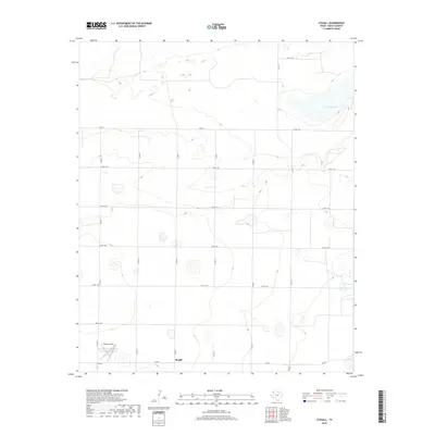
2019 Map of Stegall
USGS Topo · Published 2019About this map
Stegall and its surrounding agricultural landscape in the Texas Panhandle appear here during the late 2010s. This portion of Bailey County is characterized by a high density of depression wetlands, most notably the large basin of Coyote Lake in the northeast. The terrain is defined by a rhythmic pattern of shallow basins and low rises, typical of the Llano Estacado. The settlement pattern is sparse, oriented around a rigid grid of county roads such as Co RD 41 and Co RD 61. A small airfield, Williams Field, is situated on the western edge of the quadrangle, reflecting the importance of aerial access in this expansive cattle and cotton country. Movement through the region is facilitated by primary farm-to-market routes including Fm 746 and Fm 298, which connect isolated farmsteads across the high plains.
Find a feature on this map
17 named features on this map. Tap any name to fly to it.
Don’t see what you’re looking for? This feature index may not catch every label — zoom into the map to look around manually.
Map Details
Editions of this 2019 Stegall Map
This is the sole edition of this map. No revisions or reprints were ever made.
Other maps of this area

1954 · Clovis
USGS Topo · 1:250,000

1954 · Brownfield
USGS Topo · 1:250,000

1957 · Arch
USGS Topo · 1:62,500

1958 · Brownfield
USGS Topo · 1:250,000

1958 · Clovis
USGS Topo · 1:250,000

1962 · Brownfield
USGS Topo · 1:250,000

1962 · Stegall
USGS Topo · 1:24,000

1962 · Birdwell Ranch
USGS Topo · 1:24,000

1962 · Baileyboro NE
USGS Topo · 1:24,000

1962 · Baileyboro
USGS Topo · 1:24,000