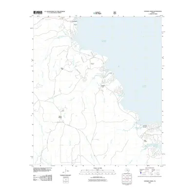
2010 Map of Stephen Creek
USGS Topo · Published 2010About this map
Livingston Reservoir and the Trinity River dominate the eastern landscape of this San Jacinto County region, where water defines the pattern of local settlement. The community of Pointblank sits near the northern shoreline, while the namesake Stephen Creek drainage flows eastward toward the reservoir. The map reveals a high density of rural cemeteries, including Liberty Hill Cemetery, Robinson Cemetery, and Mount Zion Cemetery, which serve as vital markers of local family history.
Find a feature on this map
42 named features on this map. Tap any name to fly to it.
Don’t see what you’re looking for? This feature index may not catch every label — zoom into the map to look around manually.
Map Details
Editions of this 2010 Stephen Creek Map
This is the sole edition of this map. No revisions or reprints were ever made.
Other maps of this area

1954 · Beaumont
USGS Topo · 1:250,000

1957 · Beaumont
USGS Topo · 1:250,000

1960 · Blanchard
USGS Topo · 1:24,000

1960 · Maynard
USGS Topo · 1:24,000

1960 · Carlisle
USGS Topo · 1:24,000

1960 · Stephen Creek
USGS Topo · 1:24,000

1960 · Camilla
USGS Topo · 1:24,000

1960 · Coldspring
USGS Topo · 1:24,000

1961 · Staley
USGS Topo · 1:24,000

1961 · Onalaska
USGS Topo · 1:24,000