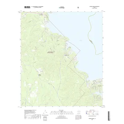
2019 Map of Stephen Creek
USGS Topo · Published 2019About this map
Sam Houston National Forest blankets the western landscape of this region, where the dense timberlands of San Jacinto County meet the expansive waters of Lake Livingston. The map captures a residential and recreational interface at the water's edge, most notably within the developed enclave of Cape Royale and the nearby Woodlands Golf Course Lake. This area is defined by numerous watercourses, including Stephen Creek, Big Spring Creek, and Dobbins Creek, which flow through the forested terrain toward the reservoir. The settlement pattern shows a blend of established rural communities and family-history landmarks. Local heritage is preserved at several burial sites, such as Mount Zion Cem, Harrell Cem, and Robinson Cem, while the small centers of Point Blank and Willow Springs anchor the inland road network. A boat launch on the northern shore highlights the transition of the local economy toward recreation.
Find a feature on this map
56 named features on this map. Tap any name to fly to it.
Don’t see what you’re looking for? This feature index may not catch every label — zoom into the map to look around manually.
Map Details
Editions of this 2019 Stephen Creek Map
This is the sole edition of this map. No revisions or reprints were ever made.
Other maps of this area

1954 · Beaumont
USGS Topo · 1:250,000

1957 · Beaumont
USGS Topo · 1:250,000

1960 · Blanchard
USGS Topo · 1:24,000

1960 · Maynard
USGS Topo · 1:24,000

1960 · Carlisle
USGS Topo · 1:24,000

1960 · Stephen Creek
USGS Topo · 1:24,000

1960 · Camilla
USGS Topo · 1:24,000

1960 · Coldspring
USGS Topo · 1:24,000

1961 · Staley
USGS Topo · 1:24,000

1961 · Onalaska
USGS Topo · 1:24,000