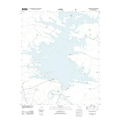
2013 Map of Stephens Gap
USGS Topo · Published 2013About this map
Broken Bow Lake dominates this 2013 topographic landscape, its intricate, finger-like shoreline reaching into the forested uplands of McCurtain County. The reservoir has submerged much of the original valley floor, though prominent elevations like Bee Creek Mtn and Carper Mtn remain as high ground above the northern reaches. To the south, the Mountain Fork river winds through a sharp canyon at Devils Backbone, creating the dramatic oxbow at Beavers Bend.
Find a feature on this map
43 named features on this map. Tap any name to fly to it.
Don’t see what you’re looking for? This feature index may not catch every label — zoom into the map to look around manually.
Map Details
Editions of this 2013 Stephens Gap Map
This is the sole edition of this map. No revisions or reprints were ever made.
Other maps of this area

1902 · Lukfata
USGS Topo · 1:125,000

1950 · Mcalester
USGS Topo · 1:250,000

1959 · Golden
USGS Topo · 1:62,500

1959 · Broken Bow
USGS Topo · 1:62,500

1960 · Bethel
USGS Topo · 1:62,500

1960 · Smithville
USGS Topo · 1:62,500

1962 · McAlester
USGS Topo · 1:250,000

1965 · McAlester
USGS Topo · 1:250,000
1976 · Broken bow NE
USGS Topo · 1:24,000
1976 · Broken Bow SW
USGS Topo · 1:24,000