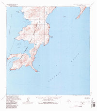
1963 Map of Stepovak Bay C-5 and C-6
USGS Topo · Published 1984About this map
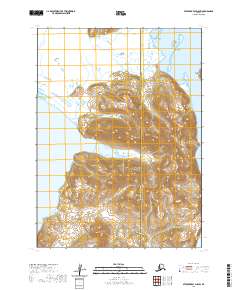
The Alaska Maritime National Wildlife Refuge Kupreanof Peninsula Unit dominates this coastal landscape, reflecting the federal conservation efforts of the early 1960s. The map details the intricate shoreline where the Alaska Peninsula meets the Pacific Ocean, characterized by a series of deep inlets including Stepovak Bay, Fox Bay, and Boulder Bay. The terrain rises sharply from a coastal Tidal Flat to several named topographic high points such as Dome Point and Cub Point. The presence of several islands, including the prominent Jacob Island with its own Noon Point, and smaller landmasses like Leader Island, highlights the complex maritime geography of the region. This 1963 survey, based on aerial photography from the late 1950s, records the uninhabited character of the peninsula's southern tip, anchored by the geographic landmark of Kupreanof Point.
Find a feature on this map
27 named features on this map. Tap any name to fly to it.
Don’t see what you’re looking for? This feature index may not catch every label — zoom into the map to look around manually.
Map Details
Editions of this 1963 Stepovak Bay C-5 and C-6 Map
2 editions found
Other maps of this area

1951 · Stepovak Bay
USGS Topo · 1:250,000
1963 · Stepovak Bay C-5 and C-6
USGS Topo · 1:63,360

1963 · Stepovak Bay D-4
USGS Topo · 1:63,360

1963 · Stepovak Bay D-6
USGS Topo · 1:63,360
1963 · Stepovak Bay B-6
USGS Topo · 1:63,360

1963 · Stepovak Bay D-5
USGS Topo · 1:63,360

1963 · Stepovak Bay
USGS Topo · 1:250,000

1969 · Stepovak Bay
USGS Topo · 1:250,000
2020 · Stepovak Bay C-5 SW
USGS Topo · 1:25,000
2020 · Stepovak Bay D-5 SW
USGS Topo · 1:25,000