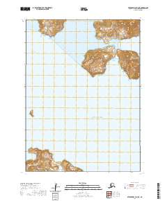
2020 Map of Stepovak Bay D-3 NE
USGS Topo · Published 2020About this map
The Alaska Peninsula coastline meets the cold waters of the North Pacific in this survey of a remote maritime environment. The topography is dominated by the jagged peaks of the Aleutian Range, which drop steeply into protected inlets such as Fishrack Bay and Mitrofania Harbor. To the south, the isolated landmass of Mitrofania Island stands as a significant landmark at the edge of the Gulf of Alaska, separated from the mainland by the waters of Mitrofania Bay. This map documents a landscape defined by its complex shorelines and high-relief coastal mountains, where names like Fish Ranch Bay suggest a history of localized maritime activity along the rugged Alaskan coast.
Find a feature on this map
14 named features on this map. Tap any name to fly to it.
Don’t see what you’re looking for? This feature index may not catch every label — zoom into the map to look around manually.
Map Details
Editions of this 2020 Stepovak Bay D-3 NE Map
This is the sole edition of this map. No revisions or reprints were ever made.
Other maps of this area

1951 · Stepovak Bay
USGS Topo · 1:250,000

1963 · Stepovak Bay D-2
USGS Topo · 1:63,360

1963 · Chignik A-2
USGS Topo · 1:63,360

1963 · Chignik A-3
USGS Topo · 1:63,360

1963 · Chignik
USGS Topo · 1:250,000
1963 · Stepovak Bay D-3
USGS Topo · 1:63,360

1963 · Stepovak Bay
USGS Topo · 1:250,000

1969 · Stepovak Bay
USGS Topo · 1:250,000
2020 · Stepovak Bay D-2 NW
USGS Topo · 1:25,000
2020 · Stepovak Bay D-3 SE
USGS Topo · 1:25,000