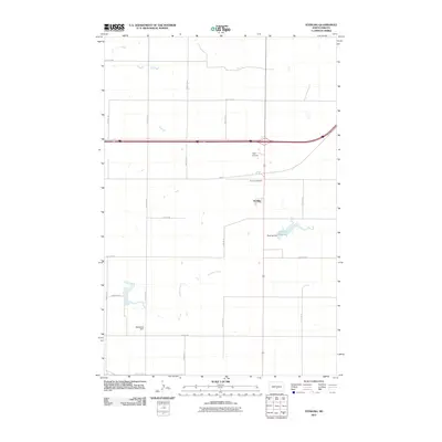
2011 Map of Sterling
USGS Topo · Published 2011About this map
The unincorporated community of Sterling anchors this Burleigh County landscape, situated at a critical junction of modern transit and local agricultural life. This 2011 survey illustrates a prairie terrain shaped by careful water management, dominated by the waters of Sterling Reservoir and the engineered control of Sterling Dam. North of the settlement, the Sterling Cemetery provides a focal point for genealogical interest, while the presence of Tops Airstrip indicates the continued importance of private aviation for regional connectivity and farm operations. To the south, the drainage of Random Creek meanders through the grid of rural sections, eventually reaching McDonald Dam. The map clearly preserves the section-line road network, including historic alignments like HWY 10 and major county connectors such as 301st St NE, showing how the land remains partitioned for large-scale agricultural use around the village center.
Find a feature on this map
25 named features on this map. Tap any name to fly to it.
Don’t see what you’re looking for? This feature index may not catch every label — zoom into the map to look around manually.
Map Details
Editions of this 2011 Sterling Map
This is the sole edition of this map. No revisions or reprints were ever made.
Other maps of this area

1951 · McKenzie
USGS Topo · 1:62,500

1951 · Driscoll
USGS Topo · 1:62,500

1954 · Bismarck
USGS Topo · 1:250,000

1958 · Bismarck
USGS Topo · 1:250,000

1971 · Moffit NW
USGS Topo · 1:24,000

1971 · Moffit
USGS Topo · 1:24,000

1975 · McKenzie
USGS Topo · 1:24,000

1975 · Sibley Butte
USGS Topo · 1:24,000

1975 · Sterling
USGS Topo · 1:24,000
1975 · McKenzie NW
USGS Topo · 1:24,000