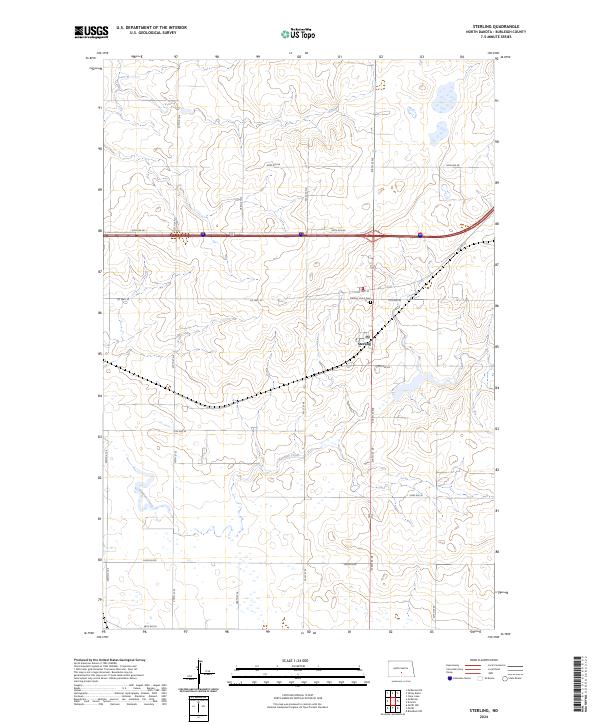
2024 Map of Sterling
USGS Topo · Published 2024About this map
Sterling serves as a central hub within the North Dakota prairie, positioned at the intersection of critical local thoroughfares. The landscape is defined by the gentle drainage patterns of Random Creek, which meanders through the southern portions of the quadrangle. For genealogists and local historians, the Sterling Union Cem and the local Po provide specific points of interest for tracing family ties and civic development in Burleigh County. The surrounding area is organized by an extensive grid of section lines and county roads, including Co Hwy 10 and Lincoln Rd, reflecting the enduring agricultural structure of the region. This 2024 data showcases the modern distribution of homesteads and farmsteads across the townships of t139n r76w and t138n r76w, documenting the current state of a long-standing rural community.
Find a feature on this map
27 named features on this map. Tap any name to fly to it.
Don’t see what you’re looking for? This feature index may not catch every label — zoom into the map to look around manually.
Map Details
Editions of this 2024 Sterling Map
This is the sole edition of this map. No revisions or reprints were ever made.
Other maps of this area

1951 · McKenzie
USGS Topo · 1:62,500

1951 · Driscoll
USGS Topo · 1:62,500

1954 · Bismarck
USGS Topo · 1:250,000

1958 · Bismarck
USGS Topo · 1:250,000

1971 · Moffit NW
USGS Topo · 1:24,000

1971 · Moffit
USGS Topo · 1:24,000

1975 · McKenzie
USGS Topo · 1:24,000

1975 · Sibley Butte
USGS Topo · 1:24,000

1975 · Sterling
USGS Topo · 1:24,000
1975 · McKenzie NW
USGS Topo · 1:24,000