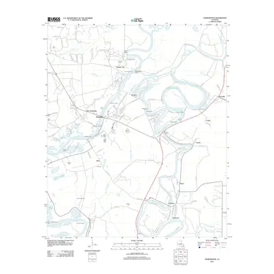
2012 Map of Sterlington
USGS Topo · Published 2012About this map
The Ouachita River winds through this landscape, defining the character of North Louisiana as it flows past the town of Sterlington. This riverine environment is shaped by a complex network of waterways, including the meandering Bayou Bartholomew and the intricate loops of Bayou De Siard. The presence of the Monroe Gas Field in the southwestern corner indicates the area's industrial importance, while numerous landings such as Hamilton Landing, Madison Landing, and Potts Landing highlight a legacy of river-based transit and commerce. Small communities and rural junctions like Ouachita City, Fairbanks, and Guthrie are scattered across the terrain, linked by parish roads that follow the natural curves of the bayous. Family history is anchored in several burial grounds, including Glendora Cem, Cook Cem, and Thompson Cem, which remain as fixed points amidst the changing floodplains and points like Parrots Beak.
Find a feature on this map
122 named features on this map. Tap any name to fly to it.
Don’t see what you’re looking for? This feature index may not catch every label — zoom into the map to look around manually.
Map Details
Editions of this 2012 Sterlington Map
This is the sole edition of this map. No revisions or reprints were ever made.
Other maps of this area

1935 · Collinston
USGS Topo · 1:62,500

1935 · Naff
USGS Topo · 1:62,500

1935 · Drew
USGS Topo · 1:62,500

1935 · Haile
USGS Topo · 1:62,500

1955 · Jackson
USGS Topo · 1:250,000

1955 · Shreveport
USGS Topo · 1:250,000

1956 · Shreveport
USGS Topo · 1:250,000

1956 · Bastrop
USGS Topo · 1:62,500

1956 · Haile
USGS Topo · 1:62,500

1957 · Monroe North
USGS Topo · 1:62,500