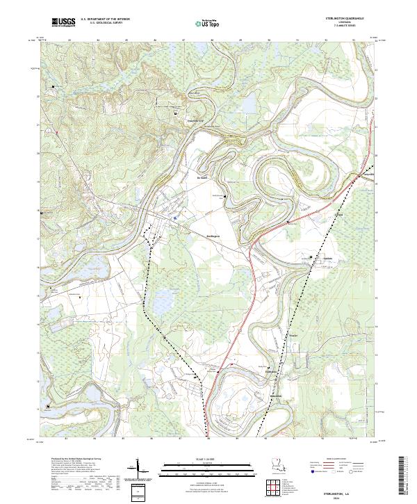
2024 Map of Sterlington
USGS Topo · Published 2024About this map
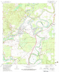
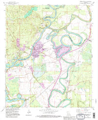
The Ouachita River defines the western landscape of this region, winding past Ouachita City and the industrial hub of Sterlington. The terrain is characterized by complex hydrology, where the river meets Bayou Bartholomew and a series of stagnant water bodies like Jim Nolan Brake and Sterlington Brake. These wetlands are preserved within the Upper Ouachita National Wildlife Refuge and Black Bayou Lake National Wildlife Refuge, indicating a landscape largely managed for conservation amidst rural development.
Find a feature on this map
128 named features on this map. Tap any name to fly to it.
Don’t see what you’re looking for? This feature index may not catch every label — zoom into the map to look around manually.
Map Details
Editions of this 2024 Sterlington Map
This is the sole edition of this map. No revisions or reprints were ever made.
Historical Maps of Fairbanks Through Time
3 maps found