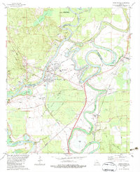
1982 Map of Sterlington
USGS Topo · Published 1983About this map
The Ouachita River defines the landscape of this northern Louisiana region, winding through a complex network of wetlands and industrial corridors. In the early 1980s, the area around Sterlington served as a significant hub for utility and chemical production, evidenced by the large Chemical Plant, Powerplant, and numerous settling ponds and waste facilities located near the riverbank. This industrial activity contrasts with the preserved natural areas at the northern edge, where the Upper Ouachita National Wildlife Refuge and Uo NWR provide sanctuary within the river's floodplains.
Find a feature on this map
68 named features on this map. Tap any name to fly to it.
Don’t see what you’re looking for? This feature index may not catch every label — zoom into the map to look around manually.
Map Details
Editions of this 1982 Sterlington Map
This is the sole edition of this map. No revisions or reprints were ever made.
Other maps of this area

1935 · Collinston
USGS Topo · 1:62,500

1935 · Naff
USGS Topo · 1:62,500

1935 · Drew
USGS Topo · 1:62,500

1935 · Haile
USGS Topo · 1:62,500

1955 · Jackson
USGS Topo · 1:250,000

1955 · Shreveport
USGS Topo · 1:250,000

1956 · Shreveport
USGS Topo · 1:250,000

1956 · Bastrop
USGS Topo · 1:62,500

1956 · Haile
USGS Topo · 1:62,500

1957 · Monroe North
USGS Topo · 1:62,500