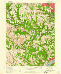
1958 Map of Steubenville West
USGS Topo · Published 1959About this map
The Ohio River corridor south of Steubenville is defined by a heavy industrial and transportation landscape in the late 1950s. The Pennsylvania railroad and various strip mines are carved into the winding valleys of Cross Creek and Georges Run. Urban expansion is evident in residential additions like Swickards Addition and Brady Estates, while the interior remains a patchwork of resource extraction and community hubs. Local institutions such as Tent Ch and the New Alexandria Cem anchor the rural landscape, while the Steubenville Pier Airport and Steubenville Country Club reflect the mid-century growth of Jefferson County. The presence of numerous Strip Mines and Oil Wells throughout the hills surrounding New Alexandria and Gould illustrates the era's intense reliance on local coal and mineral wealth.
Find a feature on this map
69 named features on this map. Tap any name to fly to it.
Don’t see what you’re looking for? This feature index may not catch every label — zoom into the map to look around manually.
Map Details
Editions of this 1958 Steubenville West Map
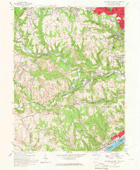
2 editions found
Other maps of this area

1901 · Cadiz
USGS Topo · 1:62,500

1902 · Wheeling
USGS Topo · 1:62,500

1903 · Cadiz
USGS Topo · 1:62,500

1904 · Steubenville
USGS Topo · 1:62,500

1905 · St. Clairsville
USGS Topo · 1:62,500

1935 · Wheeling
USGS Topo · 1:62,500

1935 · Steubenville
USGS Topo · 1:62,500

1942 · Wheeling
USGS Topo · 1:62,500

1942 · Steubenville
USGS Topo · 1:62,500

1951 · Canton
USGS Topo · 1:250,000