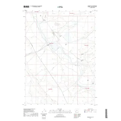
2017 Map of Stevens Flat
USGS Topo · Published 2017About this map
The Green River carves a winding path through this corner of Sweetwater County, shaping the surrounding basins and high points of the Wyoming landscape. Central to the map is the plateau of Stevens Flat, flanked by several intricate drainage systems including Stevens Draw and Demming Draw. The presence of Stevens Draw Reservoir indicates a managed approach to the area's arid water resources, while terrain markers such as Monument Hill and the river-bound Big Island provide distinct navigational points. Industrial and transport activity is traced through several significant thoroughfares, most notably the Texasgulf Rd and the Old Stauffer Rd, which connect the remote flats and washes to the broader regional network. To the south, Manns Flat and Manns Draw offer further evidence of named topographic features tied to local history and land usage in this high-desert environment.
Find a feature on this map
25 named features on this map. Tap any name to fly to it.
Don’t see what you’re looking for? This feature index may not catch every label — zoom into the map to look around manually.
Map Details
Editions of this 2017 Stevens Flat Map
This is the sole edition of this map. No revisions or reprints were ever made.
Other maps of this area

1954 · Rock Springs
USGS Topo · 1:250,000

1958 · Rock Springs
USGS Topo · 1:250,000

1961 · Blue Point
USGS Topo · 1:24,000

1961 · Little America
USGS Topo · 1:24,000

1961 · Peru
USGS Topo · 1:24,000

1961 · Austin Ranch
USGS Topo · 1:24,000

1961 · Stevens Flat
USGS Topo · 1:24,000

1961 · Bryan
USGS Topo · 1:24,000

1962 · Rock Springs
USGS Topo · 1:250,000

1963 · Big Island Bridge
USGS Topo · 1:24,000