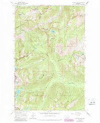
1965 Map of Stevens Pass
USGS Topo · Published 1987About this map
Stevens Pass Guard Station sits at the snowy divide of the Cascade Range, marking a critical passage for both the Burlington Northern railroad and mountain travelers. This survey captures the transition from the mid-century era to the establishment of the Alpine Lakes Wilderness, featuring the engineering feat of the Cascade Tunnel beneath Big Chief Mtn. The terrain is characterized by a dense network of glacial basins and high-elevation waters, including Josephine Lake, Lake Susan Jane, and the Thunder Mtn Lakes.
Find a feature on this map
51 named features on this map. Tap any name to fly to it.
Don’t see what you’re looking for? This feature index may not catch every label — zoom into the map to look around manually.
Map Details
Editions of this 1965 Stevens Pass Map
5 editions found
Other maps of this area

1901 · Chiwaukum
USGS Topo · 1:125,000

1902 · Skykomish
USGS Topo · 1:125,000

1904 · Chiwaukum
USGS Topo · 1:125,000

1905 · Skykomish
USGS Topo · 1:125,000

1957 · Wenatchee
USGS Topo · 1:250,000

1965 · Captain Point
USGS Topo · 1:24,000

1965 · Chiwaukum Mts
USGS Topo · 1:62,500

1965 · Stevens Pass
USGS Topo · 1:24,000

1965 · Mount Daniel
USGS Topo · 1:24,000

1965 · Wenatchee Lake
USGS Topo · 1:62,500