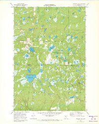
1971 Map of Stewart Lake
USGS Topo · Published 1973About this map
The boundary between Cass and Crow Wing counties bisects a densely wooded landscape defined by hundreds of small lakes and interconnected wetlands. This 1971 survey highlights the remote character of the Land O' Lakes State Forest, where seasonal routes like Winter Trail and Thompson Trail navigate the complex topography. While much of the area is undeveloped, local civic life is anchored at the Townhall and the Blind Lake Ch in the northwestern sector. The map provides a detailed look at the hydrology of the region, from the larger basins of Stewart Lake and Blind Lake to curiously named smaller waters such as Dirty House Lake and Boiler Lake. The southern portion includes the northern reaches of Fifty Lakes, showing a network of trails and primitive roads that served the logging and recreational needs of the early 1970s.
Find a feature on this map
27 named features on this map. Tap any name to fly to it.
Don’t see what you’re looking for? This feature index may not catch every label — zoom into the map to look around manually.
Map Details
Editions of this 1971 Stewart Lake Map
2 editions found
Other maps of this area

1953 · Brainerd
USGS Topo · 1:250,000

1957 · Brainerd
USGS Topo · 1:250,000

1958 · Brainerd
USGS Topo · 1:250,000

1959 · Lower Whitefish Lake
USGS Topo · 1:24,000

1959 · Jenkins
USGS Topo · 1:24,000

1960 · Cross Lake
USGS Topo · 1:24,000

1965 · Brainerd
USGS Topo · 1:250,000

1970 · Laura Lake
USGS Topo · 1:24,000
1970 · Mitchell Lake
USGS Topo · 1:24,000

1970 · Woman Lake
USGS Topo · 1:24,000