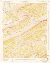
1948 Map of Stickleyville
USGS Topo · Published 1949About this map
Wallen Ridge and Stone Mountain dominate this southwest Virginia landscape, where the Jefferson National Forest covers much of the steep terrain. The Daniel Boone Trail follows the valleys through Stickleyville and Dot, providing a corridor for small communities that established roots in the shadow of Elk Knob. These settlements are marked by a dense concentration of local institutions, from Elijah Knob Sch to Robinette Memorial Ch, and family burial grounds such as Hickam Cem and Vaughn Cem.
Find a feature on this map
82 named features on this map. Tap any name to fly to it.
Don’t see what you’re looking for? This feature index may not catch every label — zoom into the map to look around manually.
Map Details
Editions of this 1948 Stickleyville Map
3 editions found
Other maps of this area

1887 · Jonesville
USGS Topo · 1:125,000

1891 · Jonesville
USGS Topo · 1:125,000

1894 · Estillville
USGS Topo · 1:125,000

1916 · Nolansburg
USGS Topo · 1:48,000

1919 · Nolansburg
USGS Topo · 1:62,500

1921 · Big Stone Gap
USGS Topo · 1:48,000

1922 · Big Stone Gap
USGS Topo · 1:62,500

1929 · Big Stone Gap
USGS Topo · 1:62,500

1935 · Kyles Ford
USGS Topo · 1:24,000

1935 · Looneys Gap
USGS Topo · 1:24,000