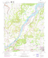
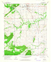
1962 Map of Stigler West
USGS Topo · Published 1979About this map
The Canadian River defines the landscape of this 1960s Haskell County survey, forming the county boundary and serving as a focal point for local industry and settlement. Near the riverbanks, evidence of extractive work is visible through numerous Sandpits, a Quarry, and a Gaging Station, while the town of Whitefield sits at a strategic crossing point. To the northeast, the community of Stigler shows its mid-century footprint, including a Drive-in Theater and a Radio Tower, reflecting the era's infrastructure.
Find a feature on this map
38 named features on this map. Tap any name to fly to it.
Don’t see what you’re looking for? This feature index may not catch every label — zoom into the map to look around manually.
Map Details
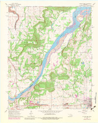
Editions of this 1962 Stigler West Map
3 editions found
Other maps of this area

1900 · Sansbois
USGS Topo · 1:125,000

1909 · Sans Bois
USGS Topo · 1:125,000

1911 · Sansbois
USGS Topo · 1:125,000

1946 · Fort Smith
USGS Topo · 1:250,000

1962 · Stigler East
USGS Topo · 1:24,000

1962 · Stigler West
USGS Topo · 1:24,000
1963 · Stigler NE
USGS Topo · 1:24,000

1963 · Porum
USGS Topo · 1:24,000
1963 · Holt Mountain
USGS Topo · 1:24,000
1963 · Warner
USGS Topo · 1:24,000