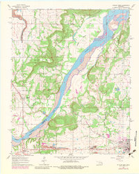
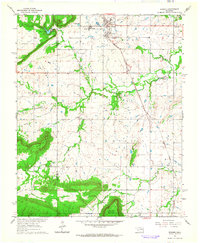
1962 Map of Stigler West
USGS Topo · Published 1983About this map
The Canadian River bisects this Oklahoma landscape, forming an indefinite boundary between Muskogee and Haskell counties. In the early 1960s, the area's geography was defined by the transition from the river bottomlands to the elevated terrain of Turkey Knob and the Porum hills. To the southeast, the town of Stigler serves as a local center of activity, while the smaller settlements of Whitefield and Briartown anchor the river crossings.
Find a feature on this map
39 named features on this map. Tap any name to fly to it.
Don’t see what you’re looking for? This feature index may not catch every label — zoom into the map to look around manually.
Map Details
Editions of this 1962 Stigler West Map
3 editions found
Other maps of this area

1900 · Sansbois
USGS Topo · 1:125,000

1909 · Sans Bois
USGS Topo · 1:125,000

1911 · Sansbois
USGS Topo · 1:125,000

1946 · Fort Smith
USGS Topo · 1:250,000

1962 · Stigler East
USGS Topo · 1:24,000

1962 · Stigler West
USGS Topo · 1:24,000
1963 · Stigler NE
USGS Topo · 1:24,000

1963 · Porum
USGS Topo · 1:24,000
1963 · Holt Mountain
USGS Topo · 1:24,000
1963 · Warner
USGS Topo · 1:24,000