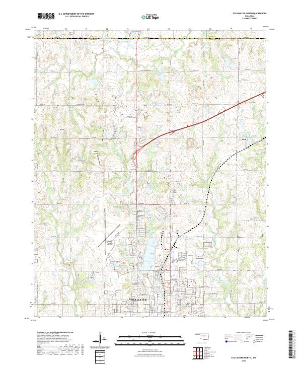
2022 Map of Stillwater North
USGS Topo · Published 2022About this map
Stillwater anchor this landscape where the university city meets the agricultural plains of northern Oklahoma. The northern edge of the city is defined by significant water management features, including Boomer Lake and Sanborn Lake, along with numerous flood control reservoirs such as Stillwater Cr Site 20 Reservoir and Stillwater Cr Site Number 26 Reservoir. This 2022 survey documents the modern layout of the Stillwater Regional Airport and the smaller Hilltop Airport, reflecting the region's importance as an aviation and transportation hub.
Find a feature on this map
82 named features on this map. Tap any name to fly to it.
Don’t see what you’re looking for? This feature index may not catch every label — zoom into the map to look around manually.
Map Details
Editions of this 2022 Stillwater North Map
This is the sole edition of this map. No revisions or reprints were ever made.
Other maps of this area

1893 · Stillwater
USGS Topo · 1:62,500

1929 · Ripley
USGS Topo · 1:62,500

1930 · Pawnee
USGS Topo · 1:62,500

1932 · Ripley
USGS Topo · 1:62,500

1936 · Pawnee
USGS Topo · 1:62,500

1955 · Enid
USGS Topo · 1:250,000

1958 · Enid
USGS Topo · 1:250,000

1966 · Lake Carl Blackwell
USGS Topo · 1:24,000
1967 · Stillwater North
USGS Topo · 1:24,000
1967 · Stillwater South
USGS Topo · 1:24,000